MyTopo
Orlando East Oklahoma US Topo Map
Couldn't load pickup availability
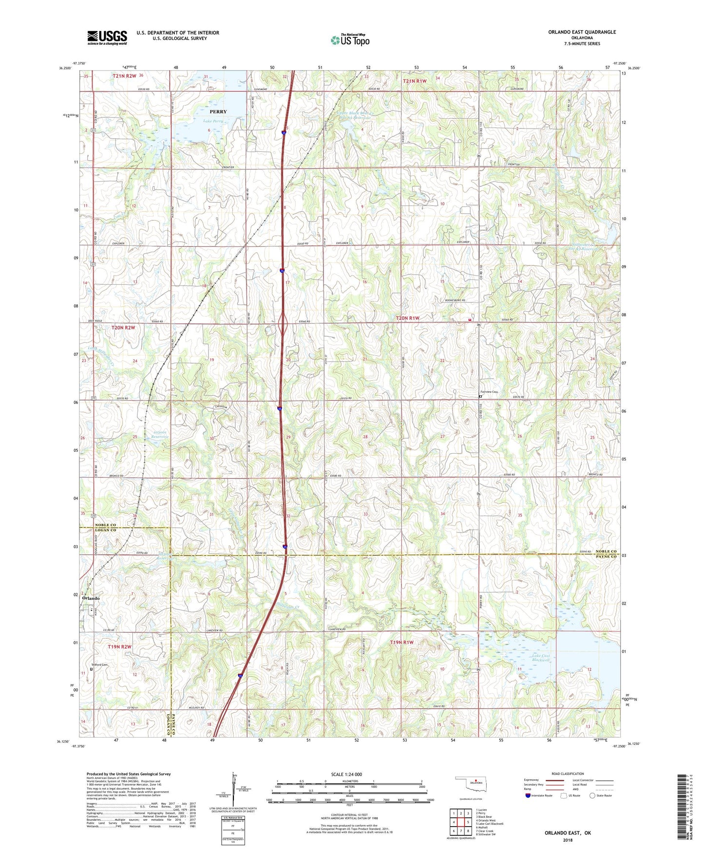
2022 topographic map quadrangle Orlando East in the state of Oklahoma. Scale: 1:24000. Based on the newly updated USGS 7.5' US Topo map series, this map is in the following counties: Noble, Payne, Logan. The map contains contour data, water features, and other items you are used to seeing on USGS maps, but also has updated roads and other features. This is the next generation of topographic maps. Printed on high-quality waterproof paper with UV fade-resistant inks.
Quads adjacent to this one:
West: Orlando West
Northwest: Lucien
North: Perry
Northeast: Black Bear
East: Lake Carl Blackwell
Southeast: Stillwater SW
South: Clear Creek
Southwest: Mulhall
This map covers the same area as the classic USGS quad with code o36097b3.
Contains the following named places: Fairview Cemetery, KJFK-FM (Perry), Lake Perry, Little Stillwater Creek, Mulhall - Orlando High School, Oknoname 083020 Dam, Oknoname 083020 Reservoir, Oknoname 103001 Dam, Oknoname 103001 Reservoir, Rock Township Rural Fire District, Stillwater Creek Site 43 Dam, Stillwater Creek Site 43 Reservoir, Tedford Cemetery, Township of Rock, Upper Black Bear Creek Site 63 Dam, Upper Black Bear Creek Site 63 Reservoir