MyTopo
Orr Oklahoma US Topo Map
Couldn't load pickup availability
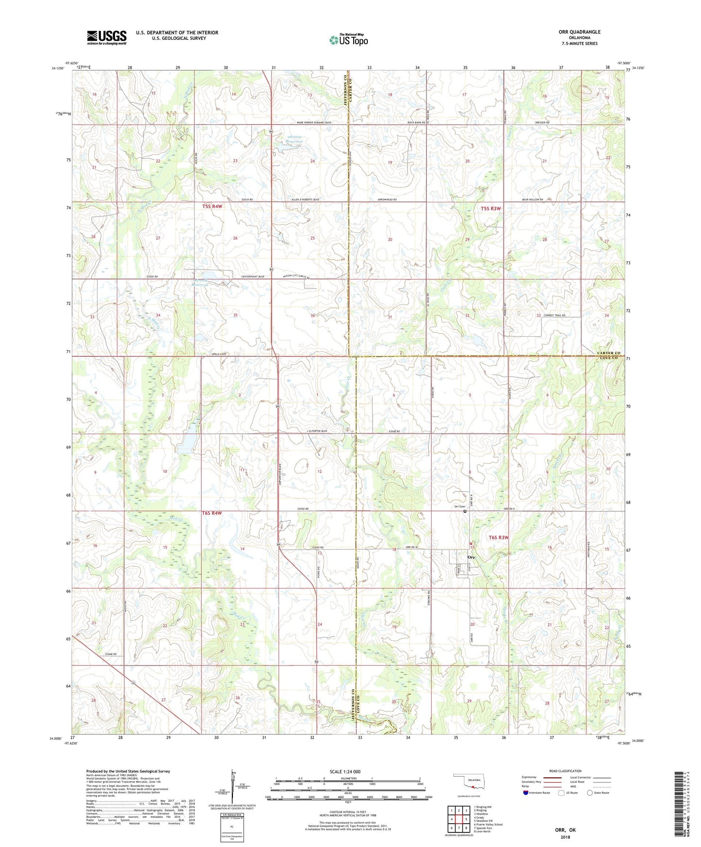
2018 topographic map quadrangle Orr in the state of Oklahoma. Scale: 1:24000. Based on the newly updated USGS 7.5' US Topo map series, this map is in the following counties: Jefferson, Love, Carter. The map contains contour data, water features, and other items you are used to seeing on USGS maps, but also has updated roads and other features. This is the next generation of topographic maps. Printed on high-quality waterproof paper with UV fade-resistant inks.
Quads adjacent to this one:
West: Grady
Northwest: Ringling NW
North: Ringling
Northeast: Healdton
East: Healdton SW
Southeast: Leon North
South: Spanish Fort
Southwest: Prairie Valley School
Contains the following named places: Center Point Church, North Mud Creek, Oknoname 067008 Dam, Oknoname 067008 Reservoir, Oknoname 067009 Dam, Oknoname 067009 Reservoir, Oknoname 067010 Dam, Oknoname 067010 Reservoir, Orr, Orr Cemetery, Orr Volunteer Fire Department, Post Oak Creek