MyTopo
Prairie Valley School Texas US Topo Map
Couldn't load pickup availability
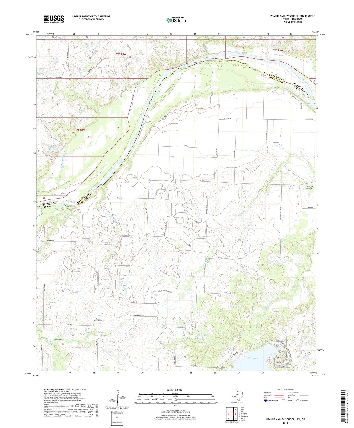
2022 topographic map quadrangle Prairie Valley School in the states of Texas, Oklahoma. Scale: 1:24000. Based on the newly updated USGS 7.5' US Topo map series, this map is in the following counties: Montague, Jefferson. The map contains contour data, water features, and other items you are used to seeing on USGS maps, but also has updated roads and other features. This is the next generation of topographic maps. Printed on high-quality waterproof paper with UV fade-resistant inks.
Quads adjacent to this one:
West: Fleetwood
Northwest: Ryan SE
North: Grady
Northeast: Orr
East: Spanish Fort
Southeast: Bonita
South: Nocona
Southwest: Belcherville
This map covers the same area as the classic USGS quad with code o33097h6.
Contains the following named places: Baker Creek, Farmers Creek Dam, Flying F Airport, Hynds City, Maddox Creek, Nocona North Spanish Fort Oil Field, Oknoname 067005 Dam, Oknoname 067005 Reservoir, Old Channel Red Creek, Oscar Cemetery, Oscar Oil Field, Panther Creek, Prairie Valley Elementary School, Prairie Valley School, Red Branch, Rowland, Spanish Fort Cemeteries, Valley View, Wolf Hollow