MyTopo
Grady Oklahoma US Topo Map
Couldn't load pickup availability
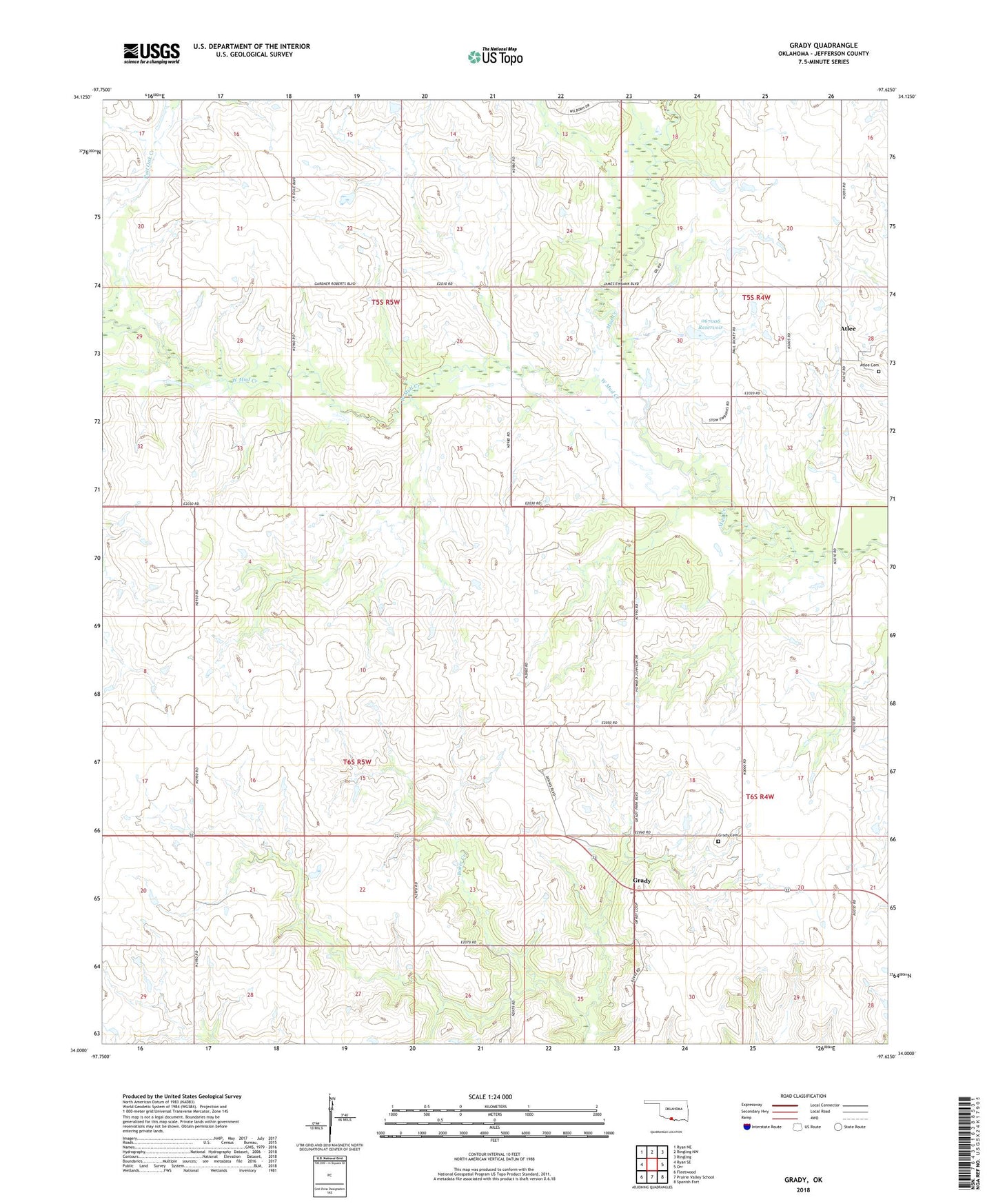
2022 topographic map quadrangle Grady in the state of Oklahoma. Scale: 1:24000. Based on the newly updated USGS 7.5' US Topo map series, this map is in the following counties: Jefferson. The map contains contour data, water features, and other items you are used to seeing on USGS maps, but also has updated roads and other features. This is the next generation of topographic maps. Printed on high-quality waterproof paper with UV fade-resistant inks.
Quads adjacent to this one:
West: Ryan SE
Northwest: Ryan NE
North: Ringling NW
Northeast: Ringling
East: Orr
Southeast: Spanish Fort
South: Prairie Valley School
Southwest: Fleetwood
This map covers the same area as the classic USGS quad with code o34097a6.
Contains the following named places: Atlee, Atlee Cemetery, Dennis Ranch Airport, Grady, Grady Cemetery, Oknoname 067006 Dam, Oknoname 067006 Reservoir, Township of Brown, Township of Wright, West Mud Creek, ZIP Code: 73456