MyTopo
Pauls Valley NE Oklahoma US Topo Map
Couldn't load pickup availability
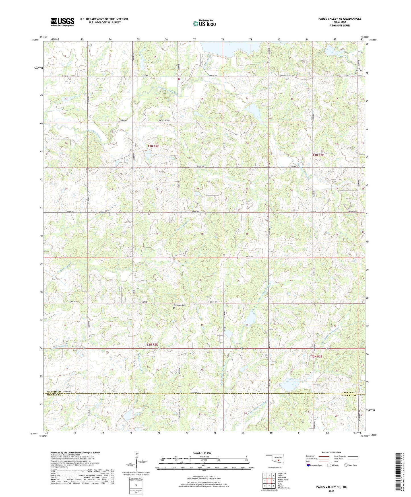
2018 topographic map quadrangle Pauls Valley NE in the state of Oklahoma. Scale: 1:24000. Based on the newly updated USGS 7.5' US Topo map series, this map is in the following counties: Garvin, Murray. The map contains contour data, water features, and other items you are used to seeing on USGS maps, but also has updated roads and other features. This is the next generation of topographic maps. Printed on high-quality waterproof paper with UV fade-resistant inks.
Quads adjacent to this one:
West: Pauls Valley
Northwest: Byars SW
North: Byars
Northeast: Stratford
East: Hart
Southeast: Sulphur North
South: Davis
Southwest: Joy
Contains the following named places: Cherokee Sandy Site 1 Dam, Cherokee Sandy Site 1 Reservoir, Cherokee Sandy Site 10 Dam, Cherokee Sandy Site 10 Reservoir, Cherokee Sandy Site 14 Dam, Cherokee Sandy Site 14 Reservoir, Cherokee Sandy Site 15 Dam, Cherokee Sandy Site 15 Reservoir, Cherokee Sandy Site 2 Dam, Cherokee Sandy Site 2 Reservoir, Cherokee Sandy Site 8 Dam, Cherokee Sandy Site 8 Reservoir, Cherokee Sandy Site 9 Dam, Cherokee Sandy Site 9 Reservoir, Chigley Sandy Creek Site 3 Reservoir, Chigley Sandy Creek Site 4 Dam, Chigley Sandy Creek Site 4 Reservoir, Chigley Sandy Creek Site 5 Dam, Chigley Sandy Creek Site 5 Reservoir, Chigley Sandy Creek Site 6 Dam, Chigley Sandy Creek Site 6 Reservoir, Chigley Snady Creek Site 3 Dam, Cottrells Mission, East Pauls Valley Oil Field, Keel Sandy Creek, Kickapoo Sandy Creek Site N2 Dam, Kickapoo Sandy Creek Site N2 Reservoir, Kickapoo Sandy Creek Site N3a Dam, Kickapoo Sandy Creek Site N3a Reservoir, Kickapoo Sandy Creek Site N3b Dam, Kickapoo Sandy Creek Site N3b Reservoir, Lewis Cemetery, Lewis Oil Field, Mount Zion Church, New Hope School, Northeast Nahola Oil Field, Oak Dale School, Oak Grove Cemetery, Rock Creek Site 1 Dam, Sandy Hill Cemetery, Sandy Hill Church, Southwest Lewis Oil Field, Stratford Division, Township of Walker, Walker Church, Walker Fire District, Walker School, Willow Sandy Creek