MyTopo
Stratford Oklahoma US Topo Map
Couldn't load pickup availability
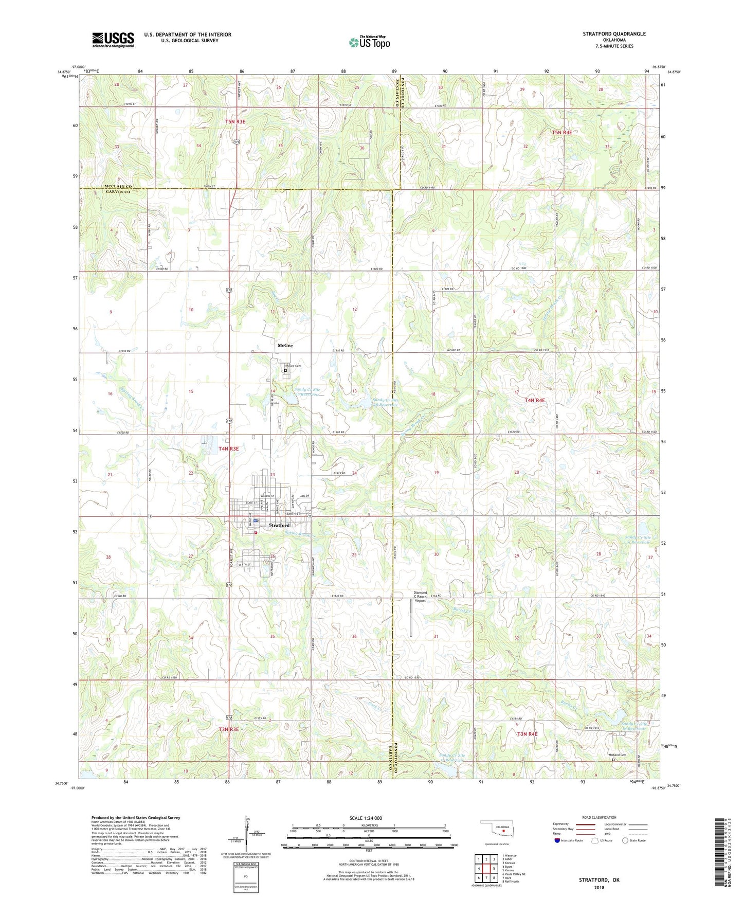
2022 topographic map quadrangle Stratford in the state of Oklahoma. Scale: 1:24000. Based on the newly updated USGS 7.5' US Topo map series, this map is in the following counties: Garvin, Pontotoc, McClain. The map contains contour data, water features, and other items you are used to seeing on USGS maps, but also has updated roads and other features. This is the next generation of topographic maps. Printed on high-quality waterproof paper with UV fade-resistant inks.
Quads adjacent to this one:
West: Byars
Northwest: Wanette
North: Asher
Northeast: Konawa
East: Vanoss
Southeast: Roff North
South: Hart
Southwest: Pauls Valley NE
This map covers the same area as the classic USGS quad with code o34096g8.
Contains the following named places: Cherokee Sandy Site 8a Dam, Cherokee Sandy Site 8a Reservoir, Diamond C Ranch Airport, McGee, McGee Cemetery, Midland Cemetery, Prairie Ridge Airport, Sandy Creek Site 17 Dam, Sandy Creek Site 17 Reservoir, Sandy Creek Site 18 Dam, Sandy Creek Site 18 Reservoir, Sandy Creek Site 19 Dam, Sandy Creek Site 19 Reservoir, Sandy Creek Site 27 Dam, Sandy Creek Site 27 Reservoir, Sandy Creek Site 28 Dam, Sandy Creek Site 28 Reservoir, Shady Grove Church, Southeast Stratford Oil Field, Stratford, Stratford Ambulance, Stratford Elementary School, Stratford Fire Department, Stratford High School, Stratford Middle School, Stratford Police Department, Stratford Post Office, Town of Stratford, ZIP Code: 74872