MyTopo
Joy Oklahoma US Topo Map
Couldn't load pickup availability
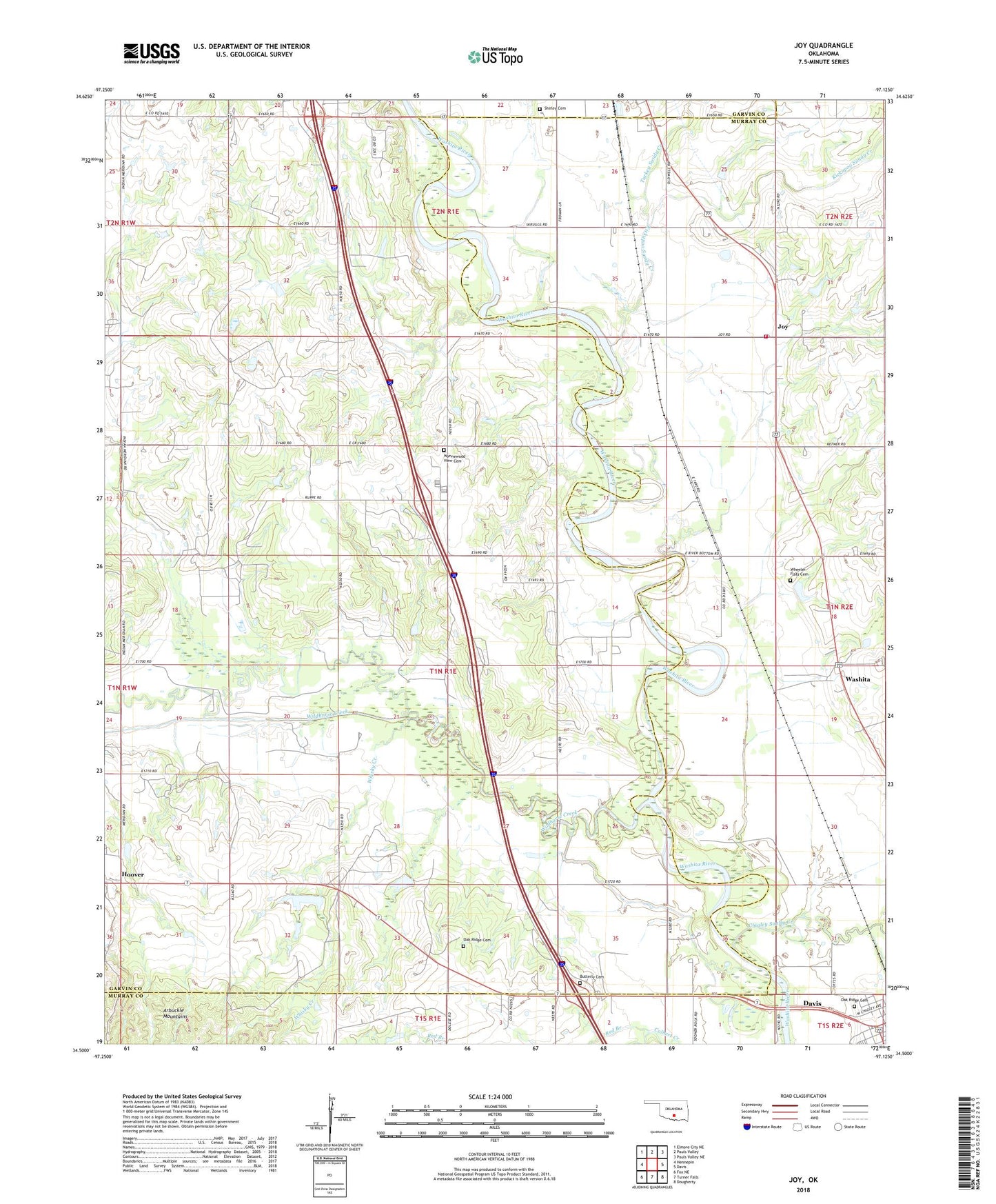
2022 topographic map quadrangle Joy in the state of Oklahoma. Scale: 1:24000. Based on the newly updated USGS 7.5' US Topo map series, this map is in the following counties: Garvin, Murray. The map contains contour data, water features, and other items you are used to seeing on USGS maps, but also has updated roads and other features. This is the next generation of topographic maps. Printed on high-quality waterproof paper with UV fade-resistant inks.
Quads adjacent to this one:
West: Hennepin
Northwest: Elmore City NE
North: Pauls Valley
Northeast: Pauls Valley NE
East: Davis
Southeast: Dougherty
South: Turner Falls
Southwest: Fox NE
This map covers the same area as the classic USGS quad with code o34097e2.
Contains the following named places: Butterly Cemetery, Chigley Sandy Creek, Colbert Creek, Fort Arbuckle Ruins, Gilfield Baptist Church, Hoover, Hoover Oil Field, Joy, Joy Community Volunteer Fire Department, Kickapoo Sandy Creek, Kickapoo Sandy Creek Site Bj3 Dam, Kickapoo Sandy Creek Site Bj3 Reservoir, Kickapoo Sandy Creek Site Bj4 Dam, Kickapoo Sandy Creek Site Bj-4 Reservoir, Kickapoo Sandy Creek Site K5 Dam, Kickapoo Sandy Creek Site K5 Reservoir, Northeast Butterly Oil Field, Oak Ridge Cemetery, Red Branch, Shirley Cemetery, South Butterly Oil Field, Southeast Hoover Oil Field, Turkey Sandy Creek, Washita, Wheeler Flats Cemetery, Whisky Creek, Wildhorse Creek, Wildhorse Creek Site 1 Dam, Wildhorse Creek Site 1 Reservoir, Wildhorse Creek Site 124 Dam, Wildhorse Creek Site 124 Reservoir, Wildhorse Creek Site 126 Dam, Wildhorse Creek Site 126 Reservoir, Wildhorse Creek Site 127 Dam, Wildhorse Creek Site 127 Reservoir, Wildhorse Creek Site 2 Dam, Wildhorse Creek Site 2 Reservoir, Wildhorse Creek Site 72 Dam, Wildhorse Creek Site 72 Reservoir, Wynnewood View Cemetery