MyTopo
Pauls Valley Oklahoma US Topo Map
Couldn't load pickup availability
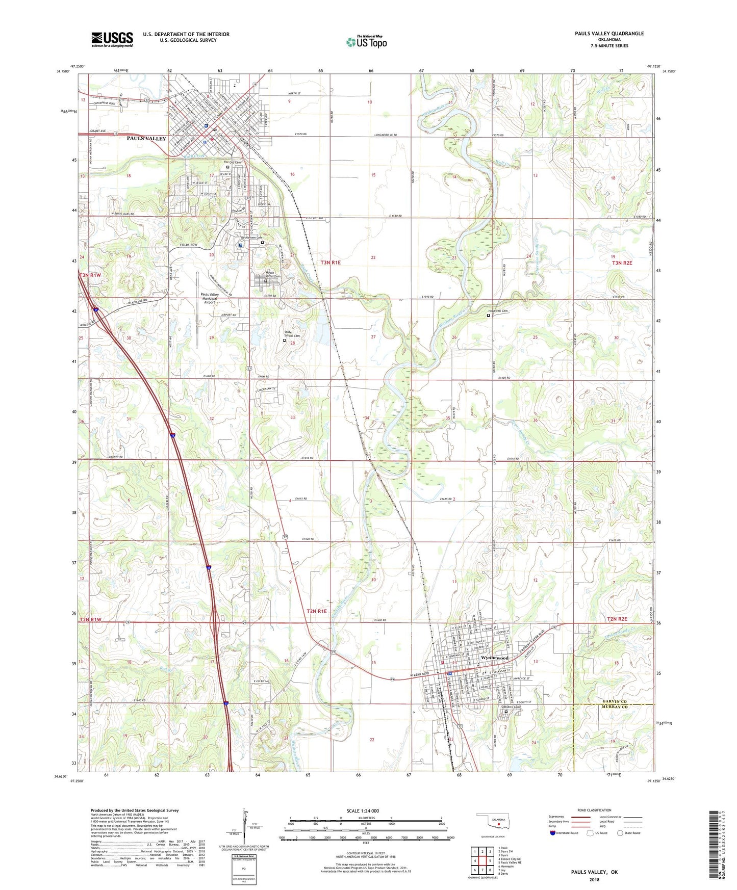
2022 topographic map quadrangle Pauls Valley in the state of Oklahoma. Scale: 1:24000. Based on the newly updated USGS 7.5' US Topo map series, this map is in the following counties: Garvin, Murray. The map contains contour data, water features, and other items you are used to seeing on USGS maps, but also has updated roads and other features. This is the next generation of topographic maps. Printed on high-quality waterproof paper with UV fade-resistant inks.
Quads adjacent to this one:
West: Elmore City NE
Northwest: Paoli
North: Byars SW
Northeast: Byars
East: Pauls Valley NE
Southeast: Davis
South: Joy
Southwest: Hennepin
This map covers the same area as the classic USGS quad with code o34097f2.
Contains the following named places: Bethlehem Baptist Church, Bethlehem Cemetery, Burr Shopping Center, Central Elementary School, Cherokee Sandy Creek, Christian Life Pentecostal Church, Church of the Nazarene, City of Pauls Valley, City of Wynnewood, Dunbar School, Faith Cathedral, Faith Temple, First Assembly of God, First Baptist Church, First Christian Church, First Church of God, Garvin County Jail, Garvin County Sheriff's Office, Gulf Junction, Hillcrest Baptist Church, Hopewell Cemetery, Jackson Elementary School, Jefferson Early Learning Center, Joy Primary School, KGOK-FM (Pauls Valley), Kickapoo Sandy Creek Site K1 Dam, Kickapoo Sandy Creek Site K1 Reservoir, Kickapoo Sandy Creek Site K7 Dam, Kickapoo Sandy Creek Site K7 Reservoir, Kickapoo Sandy Creek Site N1 Dam, Kickapoo Sandy Creek Site N1 Reservoir, Kickapoo Sandy Creek Site N4 Dam, Kickapoo Sandy Creek Site N4 Reservoir, Lee Elementary School, Life Spring Family Church, Methodist Church, Mount Carmel Baptist Church, Mount Olivet Cemetery, Negro Sandy Creek, Oaklawn Cemetery, Oknoname 04913 Dam, Oknoname 04913 Reservoir, Oknoname 04914 Dam, Oknoname 04914 Reservoir, Oknoname 04915 Dam, Oknoname 04915 Reservoir, Oknoname 04923 Dam, Oknoname 04923 Reservoir, Parkview School, Pauls Valley, Pauls Valley Division, Pauls Valley Fire Department Station 1, Pauls Valley General Hospital, Pauls Valley High School, Pauls Valley Junior High School, Pauls Valley Municipal Airport, Pauls Valley Police Department, Pauls Valley Post Office, Pauls Valley State Hospital, Pauls Valley State School, Pauls Valley State School Heliport, Presbyterian Church, Red Branch, Renavair Field, Rush Creek, Saint Timothy Church, Southeast Pauls Valley Oil Field, Southside Church, State School Cemetery, The Old Cemetery, United Pentecostal Church, Valley Christian Church, Wacker Park, Wolf Creek, Wynnewood, Wynnewood Fire Department, Wynnewood First United Methodist Church, Wynnewood High School, Wynnewood Middle School, Wynnewood Police Dept, Wynnewood Post Office, ZIP Codes: 73075, 73098