MyTopo
Pearsonia NE Oklahoma US Topo Map
Couldn't load pickup availability
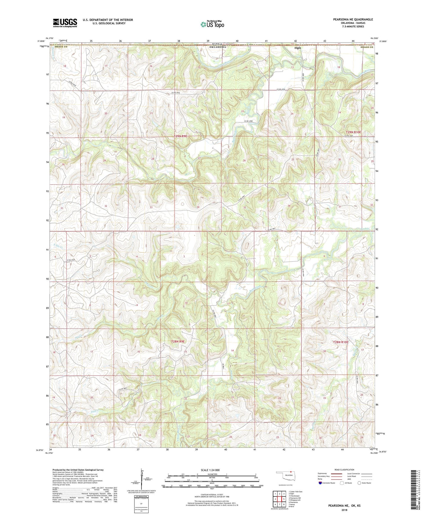
2018 topographic map quadrangle Pearsonia NE in the state of Oklahoma. Scale: 1:24000. Based on the newly updated USGS 7.5' US Topo map series, this map is in the following counties: Osage, Chautauqua. The map contains contour data, water features, and other items you are used to seeing on USGS maps, but also has updated roads and other features. This is the next generation of topographic maps. Printed on high-quality waterproof paper with UV fade-resistant inks.
Quads adjacent to this one:
West: Pearsonia NW
Northwest: Cedar Vale East
North: Elgin
Northeast: Chautauqua
East: Whippoorwill
Southeast: Herd
South: Nanos
Southwest: Pearsonia
Contains the following named places: Buck Creek, Dry Creek, North Fox Creek, Oknoname 037045 Dam, Oknoname 037045 Reservoir, Oknoname 037046 Dam, Oknoname 037046 Reservoir, Oknoname 113116 Dam, Oknoname 113116 Reservoir, South Fork Pond Creek