MyTopo
Cedar Vale East Kansas US Topo Map
Couldn't load pickup availability
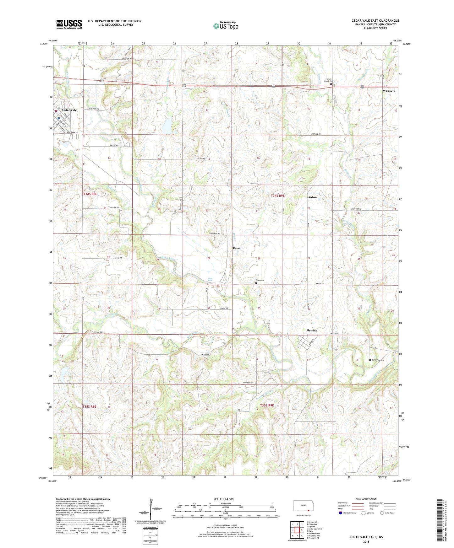
2022 topographic map quadrangle Cedar Vale East in the state of Kansas. Scale: 1:24000. Based on the newly updated USGS 7.5' US Topo map series, this map is in the following counties: Chautauqua. The map contains contour data, water features, and other items you are used to seeing on USGS maps, but also has updated roads and other features. This is the next generation of topographic maps. Printed on high-quality waterproof paper with UV fade-resistant inks.
Quads adjacent to this one:
West: Cedar Vale West
Northwest: Dexter NE
North: Cloverdale
Northeast: Elgin NE
East: Elgin
Southeast: Pearsonia NE
South: Pearsonia NW
Southwest: Foraker North
This map covers the same area as the classic USGS quad with code o37096a4.
Contains the following named places: Cedar Creek, Cedar Vale Ambulance and Rescue, Cedar Vale City Hall, Cedar Vale Community Hospital, Cedar Vale Fire Department, Cedar Vale Memorial Library, Cedar Vale Museum, Cedar Vale Police Department, Cedar Vale Post Office, Cedar Vale United Methodist Church, Cedar Vale Wastewater Treatment Plant, Church of Christ, Dry Creek, First Baptist Church, Frontier Christian Fellowship, Grant Creek Cemetery, Hewins, Hewins Park, Layton, Osro, Osro Falls, Ozro Cemetery, Possum Trot Creek, Rock Creek, Rose Dale Cemetery, Shanghai Creek, Spring Branch, Township of Harrison, Wauneta, Wauneta United Methodist Church, ZIP Code: 67024