MyTopo
Elgin Kansas US Topo Map
Couldn't load pickup availability
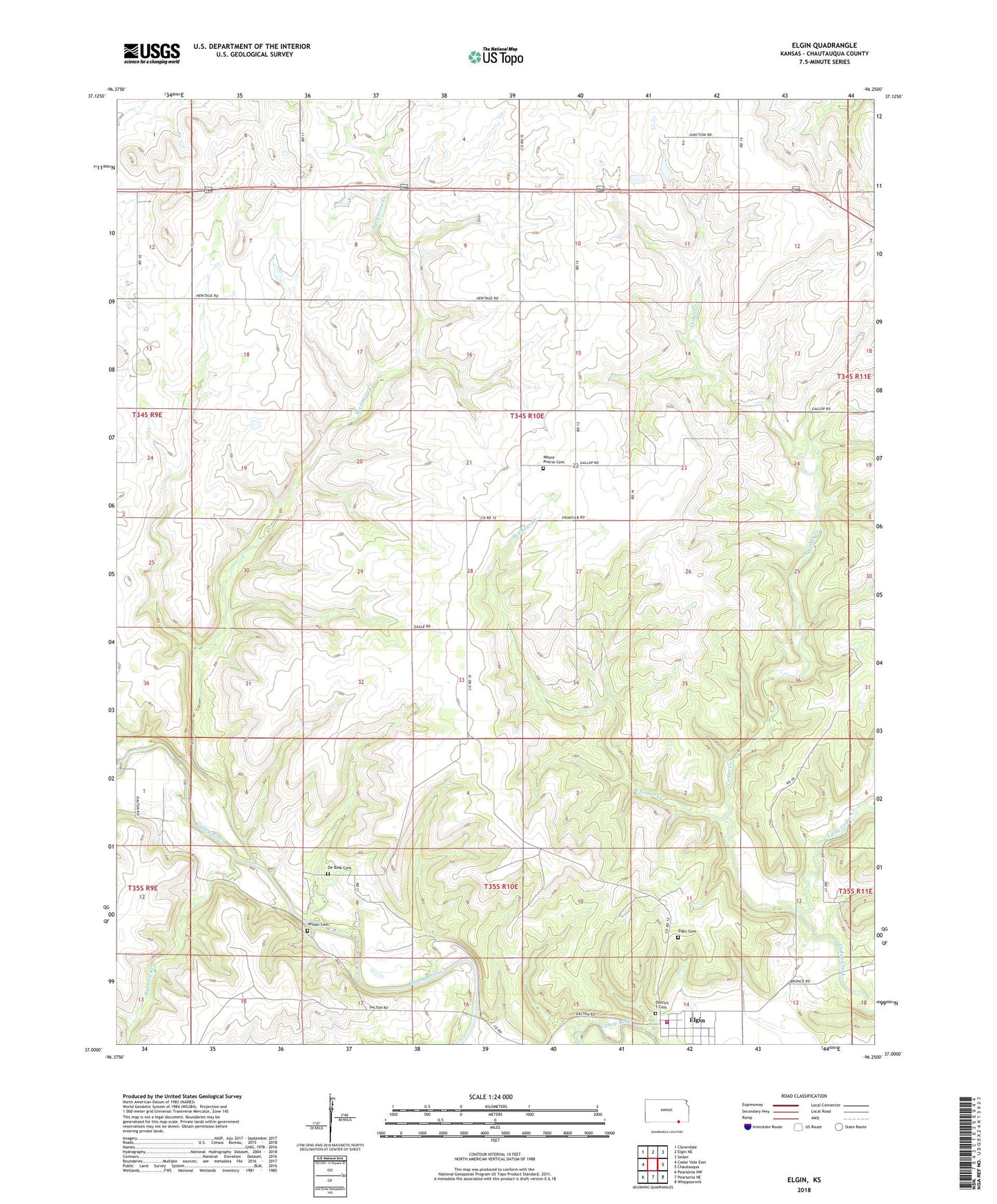
2022 topographic map quadrangle Elgin in the state of Kansas. Scale: 1:24000. Based on the newly updated USGS 7.5' US Topo map series, this map is in the following counties: Chautauqua. The map contains contour data, water features, and other items you are used to seeing on USGS maps, but also has updated roads and other features. This is the next generation of topographic maps. Printed on high-quality waterproof paper with UV fade-resistant inks.
Quads adjacent to this one:
West: Cedar Vale East
Northwest: Cloverdale
North: Elgin NE
Northeast: Sedan
East: Chautauqua
Southeast: Whippoorwill
South: Pearsonia NE
Southwest: Pearsonia NW
This map covers the same area as the classic USGS quad with code o37096a3.
Contains the following named places: Buzzard Creek, Chautauqua County Rural Fire District 5 Elgin Station, City of Elgin, De Bask Cemetery, Elgin, Elgin Cemetery, Elgin Community Center, Elgin United Methodist Church, Grant Creek, Hudson, Hulah Wildlife Area, Little Cedar Creek, Magee Cemetery, Moore Prairie Cemetery, New Elgin, Sycamore Creek, Township of Hendricks, West Cedar Creek, Wilson Cemetery