MyTopo
Plainview Oklahoma US Topo Map
Couldn't load pickup availability
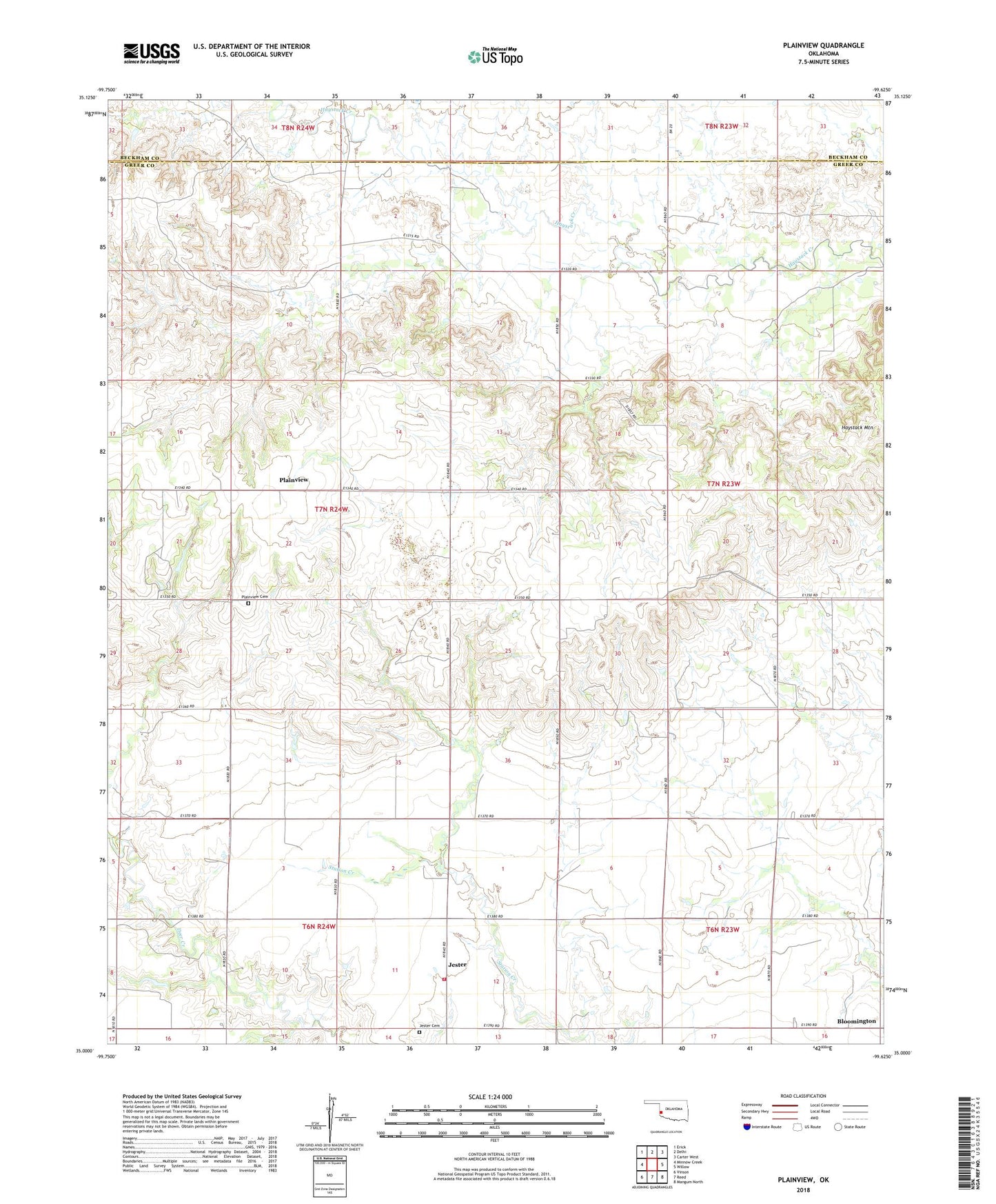
2022 topographic map quadrangle Plainview in the state of Oklahoma. Scale: 1:24000. Based on the newly updated USGS 7.5' US Topo map series, this map is in the following counties: Greer, Beckham. The map contains contour data, water features, and other items you are used to seeing on USGS maps, but also has updated roads and other features. This is the next generation of topographic maps. Printed on high-quality waterproof paper with UV fade-resistant inks.
Quads adjacent to this one:
West: Minnow Creek
Northwest: Erick
North: Delhi
Northeast: Carter West
East: Willow
Southeast: Mangum North
South: Reed
Southwest: Vinson
This map covers the same area as the classic USGS quad with code o35099a6.
Contains the following named places: Bloomington, Deer Creek Church, Haystack Mountain, Jester, Jester Cemetery, Jester Volunteer Fire Department, Northwest Greer Division, Plainview, Plainview Cemetery, Township of Raney