MyTopo
Pocasset Oklahoma US Topo Map
Couldn't load pickup availability
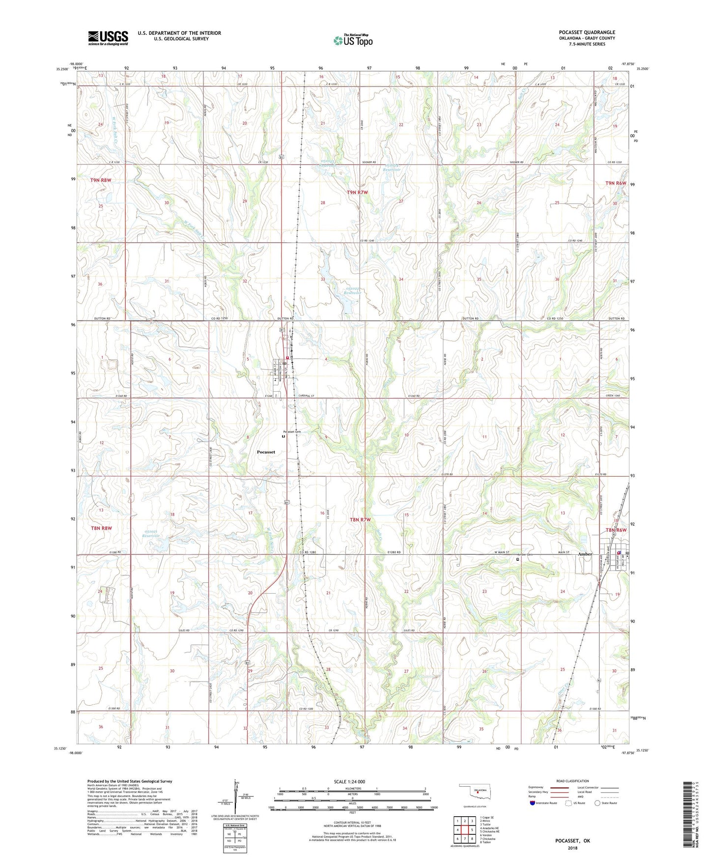
2022 topographic map quadrangle Pocasset in the state of Oklahoma. Scale: 1:24000. Based on the newly updated USGS 7.5' US Topo map series, this map is in the following counties: Grady. The map contains contour data, water features, and other items you are used to seeing on USGS maps, but also has updated roads and other features. This is the next generation of topographic maps. Printed on high-quality waterproof paper with UV fade-resistant inks.
Quads adjacent to this one:
West: Anadarko NE
Northwest: Cogar SE
North: Minco
Northeast: Tuttle
East: Chickasha NE
Southeast: Tabler
South: Chickasha
Southwest: Verden
This map covers the same area as the classic USGS quad with code o35097b8.
Contains the following named places: Amber, Amber - Pocasset Elementary School, Amber - Pocasset Junior High School, Amber Cemetery, Amber Police Department, Amber Post Office, Amber Volunteer Fire Department, Grady County Fire Department Pocasset Station, Oknoname 051021 Dam, Oknoname 051021 Reservoir, Oknoname 051022 Dam, Oknoname 051022 Reservoir, Oknoname 051023 Dam, Oknoname 051023 Reservoir, Oknoname 051024 Dam, Oknoname 051024 Reservoir, Oknoname 051025 Dam, Oknoname 051025 Reservoir, Pocasset, Pocasset Cemetery, Pocasset Post Office, Town of Amber, Town of Pocasset, Township of Pocasset, West Fork Salt Creek