MyTopo
Tuttle Oklahoma US Topo Map
Couldn't load pickup availability
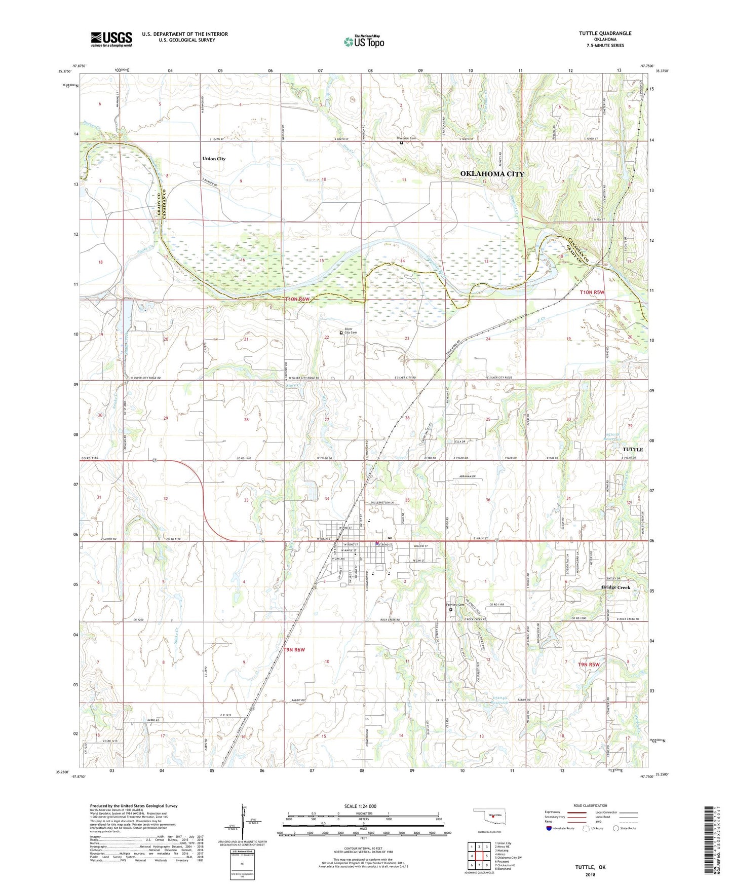
2022 topographic map quadrangle Tuttle in the state of Oklahoma. Scale: 1:24000. Based on the newly updated USGS 7.5' US Topo map series, this map is in the following counties: Grady, Canadian. The map contains contour data, water features, and other items you are used to seeing on USGS maps, but also has updated roads and other features. This is the next generation of topographic maps. Printed on high-quality waterproof paper with UV fade-resistant inks.
Quads adjacent to this one:
West: Minco
Northwest: Union City
North: Minco NE
Northeast: Mustang
East: Oklahoma City SW
Southeast: Blanchard
South: Chickasha NE
Southwest: Pocasset
This map covers the same area as the classic USGS quad with code o35097c7.
Contains the following named places: Beaver Creek, Bennett Creek, Church of Christ, City of Tuttle, Dry Creek, Fairview Cemetery, First Assembly of God Church, First Baptist Church of Tuttle, Fisher Lake, Fisher Lake Dam, Foreman Creek, Liberty Christian Fellowship Church, New Heights Baptist Church, Oknoname 051038 Dam, Oknoname 051038 Reservoir, Oknoname 051040 Dam, Oknoname 051040 Reservoir, Riverside Cemetery, Silver City Cemetery, Snake Creek, Store Creek, Township of Tuttle, Tuttle, Tuttle Christian Church, Tuttle Division, Tuttle Elementary School, Tuttle Emergency Medical Services, Tuttle Fire Department, Tuttle High School, Tuttle Intermediate School, Tuttle Middle School, Tuttle Police Department, Tuttle Post Office, West Creek, ZIP Code: 73089