MyTopo
Purdy Oklahoma US Topo Map
Couldn't load pickup availability
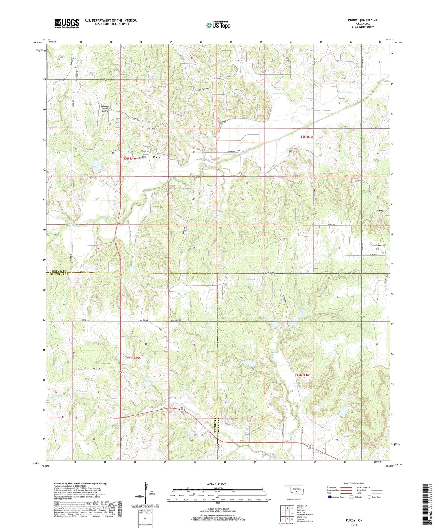
2018 topographic map quadrangle Purdy in the state of Oklahoma. Scale: 1:24000. Based on the newly updated USGS 7.5' US Topo map series, this map is in the following counties: Garvin, Stephens. The map contains contour data, water features, and other items you are used to seeing on USGS maps, but also has updated roads and other features. This is the next generation of topographic maps. Printed on high-quality waterproof paper with UV fade-resistant inks.
Quads adjacent to this one:
West: Cox City
Northwest: Lindsay SW
North: Lindsay
Northeast: Maysville
East: Elmore City North
Southeast: Elmore City South
South: Pernell
Southwest: Lake Fuqua
Contains the following named places: Bearden Private Airstrip, Camp Keno Taunee, Doyle Church, Doyle School, Doyle Volunteer Fire Department, Mountain View Church, Purdy, Purdy Cemetery, Rush Creek Site 28 Dam, Rush Creek Site 28 Reservoir, Rush Creek Site 29 Dam, Rush Creek Site 29 Reservoir, Rush Creek Site 31 Dam, Rush Creek Site 31 Reservoir, Wildhorse Creek Site 87 Dam, Wildhorse Creek Site 87 Reservoir, Wildhorse Creek Site 89 Dam, Wildhorse Creek Site 89 Reservoir, Wildhorse Creek Site 90 Dam, Wildhorse Creek Site 90 Reservoir, Wildhorse Creek Site 92 Dam, Wildhorse Creek Site 92 Reservoir, Wildhorse Creek Site 93 Dam, Wildhorse Creek Site 93 Reservoir, Wildhorse Creek Site 94 Dam, Wildhorse Creek Site 94 Reservoir, Wildhorse Creek Site 95 Dam, Wildhorse Creek Site 95 Reservoir, Wildhorse Creek Site 96 Dam, Wildhorse Creek Site 96 Reservoir