MyTopo
Lake Fuqua Oklahoma US Topo Map
Couldn't load pickup availability
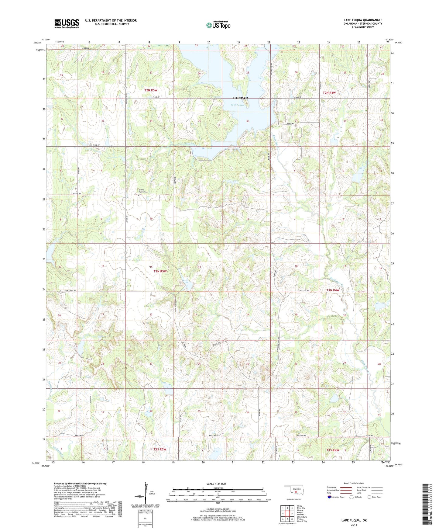
2022 topographic map quadrangle Lake Fuqua in the state of Oklahoma. Scale: 1:24000. Based on the newly updated USGS 7.5' US Topo map series, this map is in the following counties: Stephens. The map contains contour data, water features, and other items you are used to seeing on USGS maps, but also has updated roads and other features. This is the next generation of topographic maps. Printed on high-quality waterproof paper with UV fade-resistant inks.
Quads adjacent to this one:
West: Hope
Northwest: Bray
North: Cox City
Northeast: Purdy
East: Pernell
Southeast: Ratliff City
South: Velma
Southwest: Harrisburg
This map covers the same area as the classic USGS quad with code o34097e6.
Contains the following named places: Camp E-Ko-Wah, Lake Fuqua, Oknoname 137051 Dam, Oknoname 137051 Reservoir, Oknoname 137052 Dam, Oknoname 137052 Reservoir, Oknoname 137054 Dam, Oknoname 137054 Reservoir, Oknoname 137074 Dam, Oknoname 137074 Reservoir, Owens Prairie Cemetery, Owens Prairie Church, Township of Hope, Wildhorse Creek Site 31 Dam, Wildhorse Creek Site 31 Reservoir, Wildhorse Creek Site 32 Dam, Wildhorse Creek Site 32 Reservoir, Wildhorse Creek Site 33 Dam, Wildhorse Creek Site 33 Reservoir, Wildhorse Creek Site 34 Dam, Wildhorse Creek Site 34 Reservoir, Wildhorse Creek Site 37 Dam, Wildhorse Creek Site 37 Reservoir, Wildhorse Creek Site 38 Dam, Wildhorse Creek Site 38 Reservoir, Wildhorse Creek Site 39 Dam, Wildhorse Creek Site 39 Reservoir, Wildhorse Creek Site 40 Dam, Wildhorse Creek Site 40 Reservoir, Wildhorse Creek Site 41 Dam, Wildhorse Creek Site 41 Reservoir, Wildhorse Creek Site 42 Dam, Wildhorse Creek Site 42 Reservoir