MyTopo
Qualls Oklahoma US Topo Map
Couldn't load pickup availability
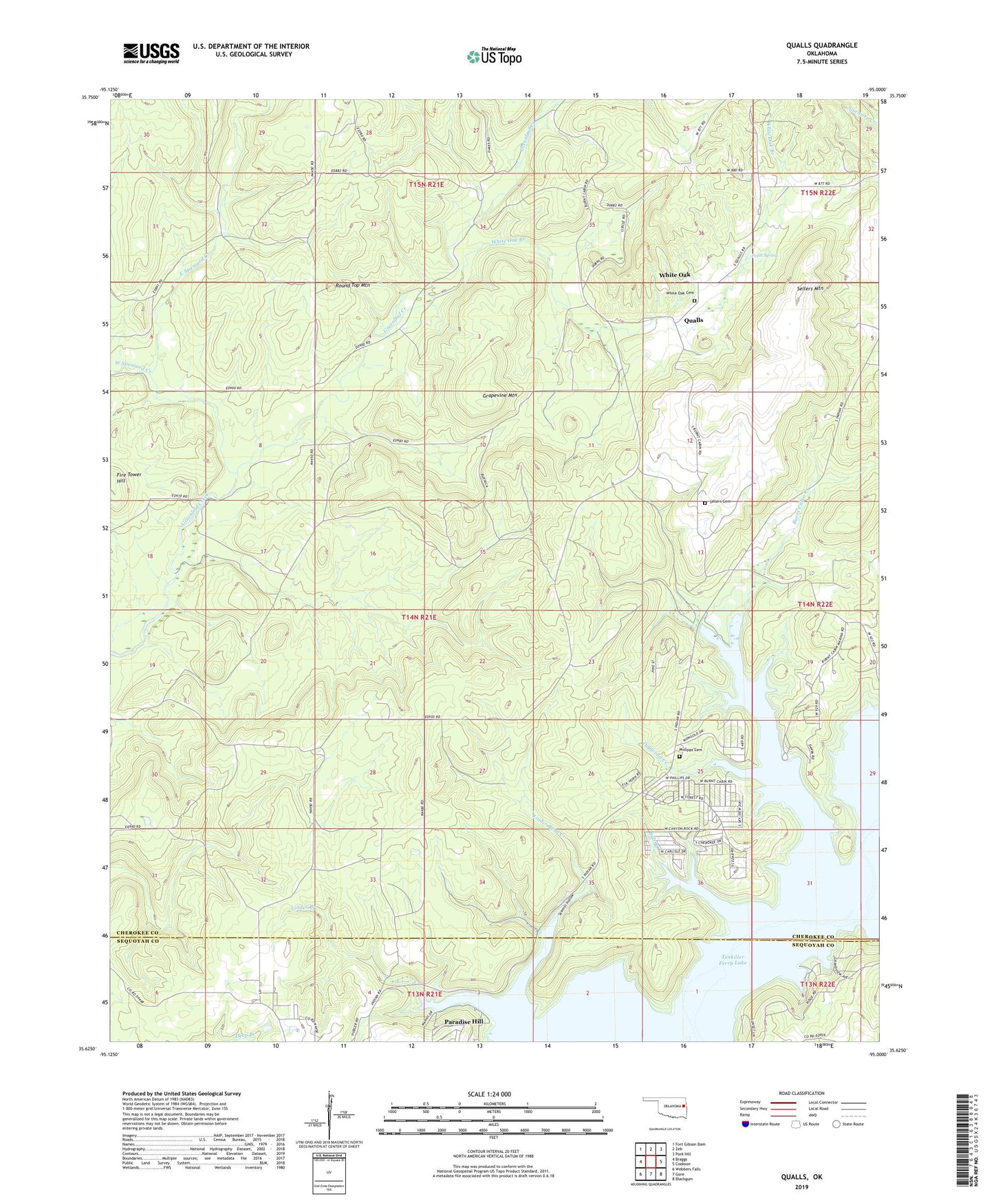
2019 topographic map quadrangle Qualls in the state of Oklahoma. Scale: 1:24000. Based on the newly updated USGS 7.5' US Topo map series, this map is in the following counties: Cherokee, Sequoyah. The map contains contour data, water features, and other items you are used to seeing on USGS maps, but also has updated roads and other features. This is the next generation of topographic maps. Printed on high-quality waterproof paper with UV fade-resistant inks.
Quads adjacent to this one:
West: Braggs
Northwest: Fort Gibson Dam
North: Zeb
Northeast: Park Hill
East: Cookson
Southeast: Blackgum
South: Gore
Southwest: Webbers Falls
Contains the following named places: Burnt Cabin Creek, Burnt Cabin Ridge State Park, Cherokee Non-Community, Cherokee State Game Refuge, Dogwood Creek, East Spaniard Creek, Fire Tower Hill, Grapevine Mountain, Linder Bend Creek, Linder Branch, Oknoname 111088 Dam, Oknoname 111088 Reservoir, Paradise Hill, Petitt Spring, Phillips Cemetery, Qualls, Round Top Mountain, Salt Branch, Sawmill Hollow, Sellers Cemetery, Sellers Mountain, Spaniard Creek, Tenkiller Wildlife Managment Area, West Spaniard Creek, White Oak, White Oak Branch, White Oak Cemetery