MyTopo
Red Oak Oklahoma US Topo Map
Couldn't load pickup availability
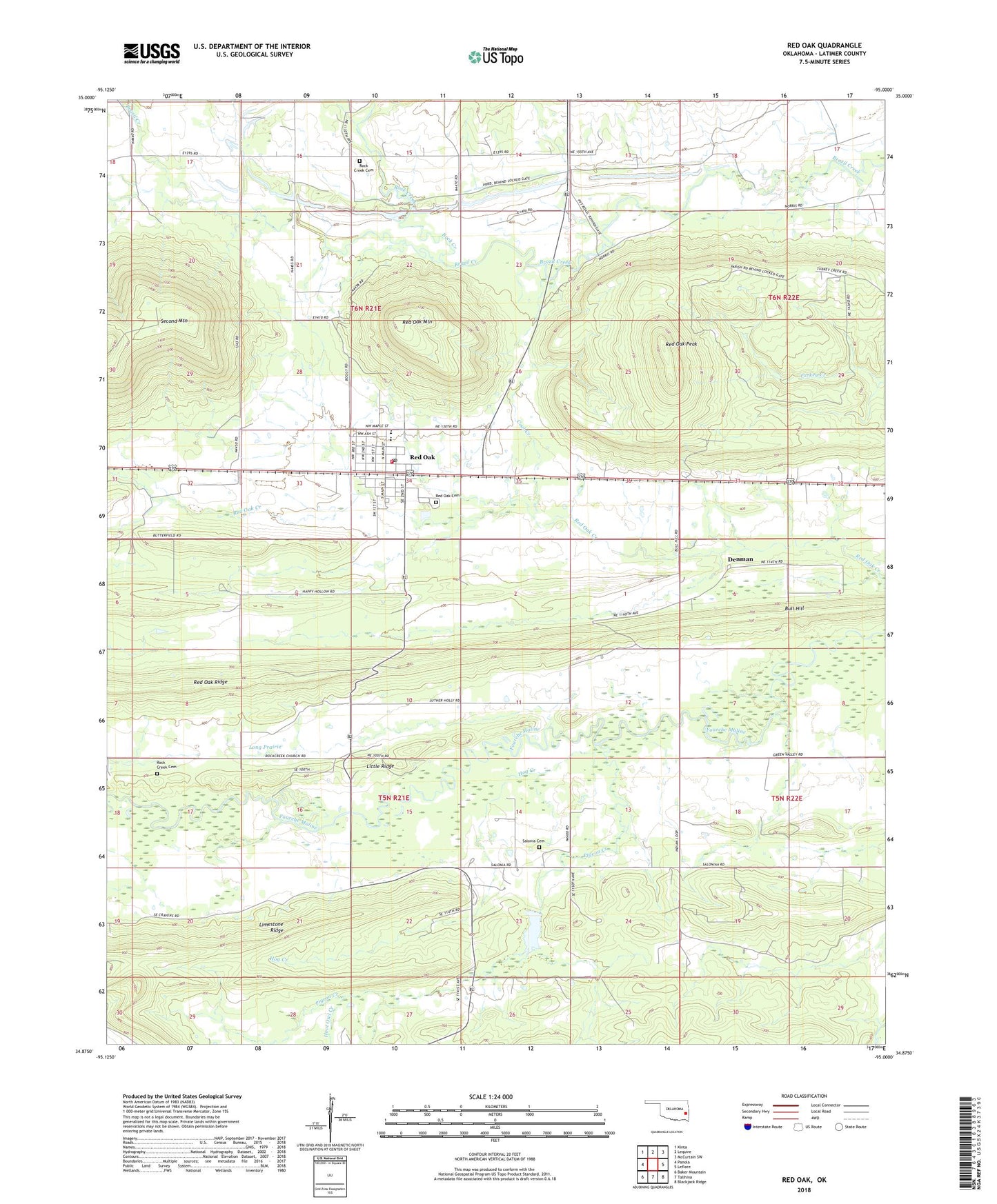
2018 topographic map quadrangle Red Oak in the state of Oklahoma. Scale: 1:24000. Based on the newly updated USGS 7.5' US Topo map series, this map is in the following counties: Latimer. The map contains contour data, water features, and other items you are used to seeing on USGS maps, but also has updated roads and other features. This is the next generation of topographic maps. Printed on high-quality waterproof paper with UV fade-resistant inks.
Quads adjacent to this one:
West: Panola
Northwest: Kinta
North: Lequire
Northeast: McCurtain SW
East: Leflore
Southeast: Blackjack Ridge
South: Talihina
Southwest: Baker Mountain
Contains the following named places: Bull Hill, Coal Creek, Denman, Fourche Maline Creek Site 12 Dam, Fourche Maline Creek Site 12 Reservoir, Hog Creek, Hoot Owl Creek, Little Ridge, Long Prairie, Pigeon Creek, Red Oak, Red Oak Cemetery, Red Oak Division, Red Oak Elementary School, Red Oak Fire Department, Red Oak High School, Red Oak Mountain, Red Oak Peak, Red Oak Post Office, Red Oak Ridge, Rock Creek, Rock Creek Cemetery, Rock Creek Church, Salonia Cemetery, South Rock Creek Cemetery, Town of Red Oak, Township of Red Oak, Wister Wildlife Management Area, ZIP Code: 74563