MyTopo
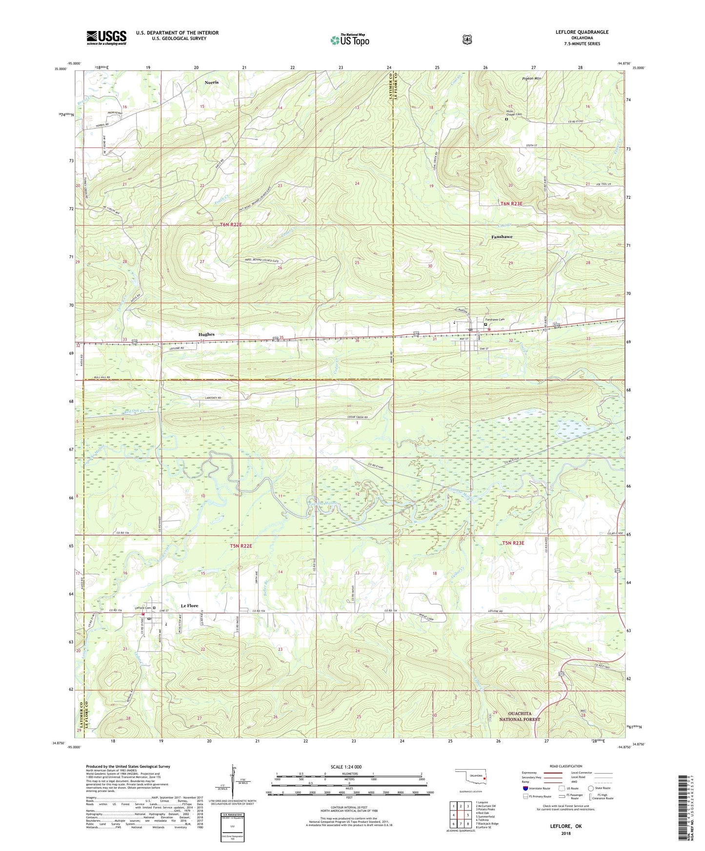
Leflore Oklahoma US Topo Map
Couldn't load pickup availability
Also explore the Leflore Forest Service Topo of this same quad for updated USFS data
2022 topographic map quadrangle Leflore in the state of Oklahoma. Scale: 1:24000. Based on the newly updated USGS 7.5' US Topo map series, this map is in the following counties: Le Flore, Latimer. The map contains contour data, water features, and other items you are used to seeing on USGS maps, but also has updated roads and other features. This is the next generation of topographic maps. Printed on high-quality waterproof paper with UV fade-resistant inks.
Quads adjacent to this one:
West: Red Oak
Northwest: Lequire
North: McCurtain SW
Northeast: Potato Peaks
East: Summerfield
Southeast: Leflore SE
South: Blackjack Ridge
Southwest: Talihina
This map covers the same area as the classic USGS quad with code o34094h8.
Contains the following named places: Baker Branch, Cedar Creek, Fanshawe, Fanshawe Cemetery, Fanshawe Elementary School, Fanshawe Fire Department, Fanshawe Post Office, Hicks Chapel Cemetery, Hughes, Le Flore Fire Department, Leflore, LeFlore Cemetery, Leflore Elementary School, Leflore High School, Leflore Post Office, Long Creek, Norris, Red Oak Creek, Town of Fanshawe, Town of Le Flore, Township of Summerfield, Turkey Creek, ZIP Codes: 74935, 74942