MyTopo
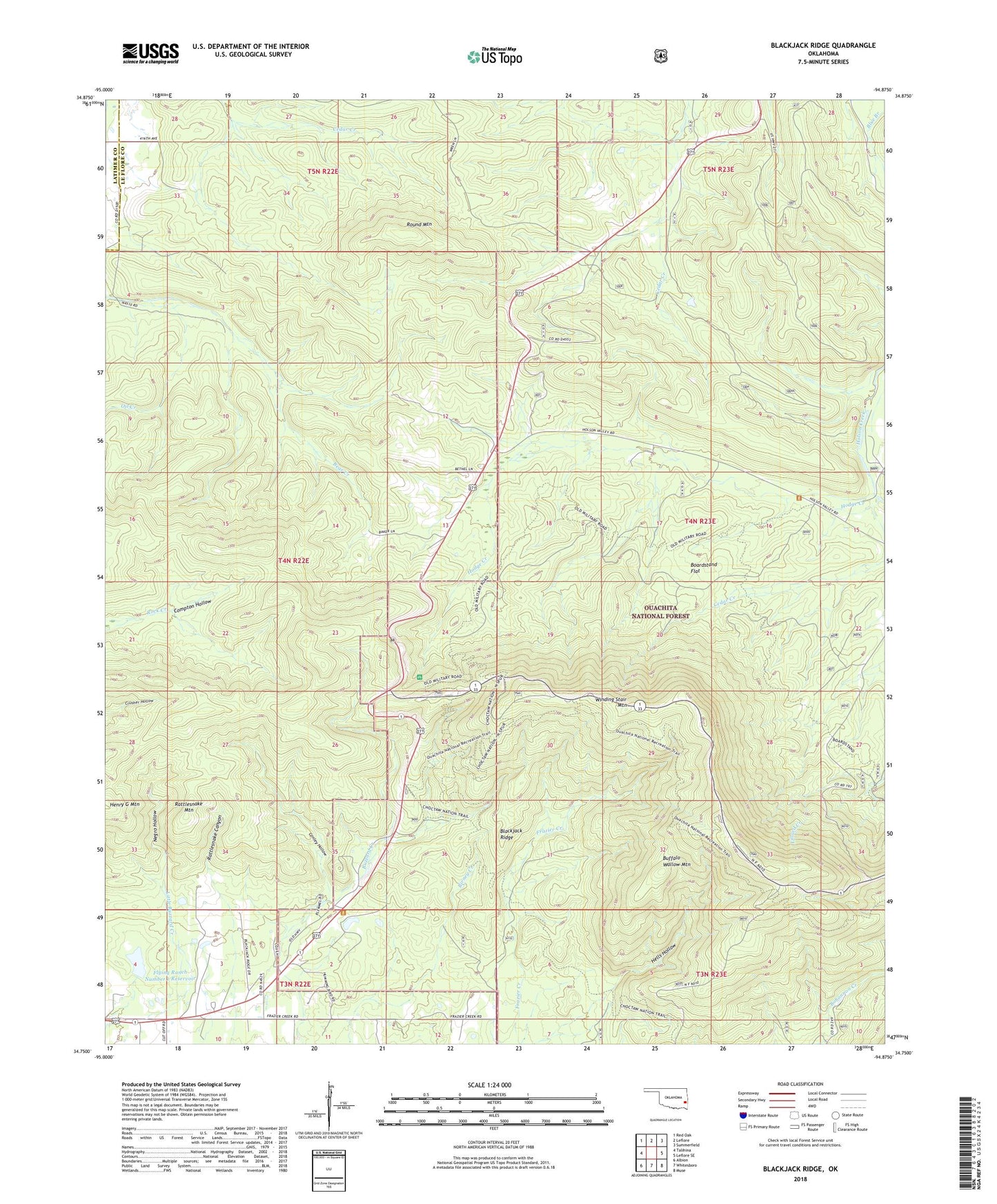
Blackjack Ridge Oklahoma US Topo Map
Couldn't load pickup availability
Also explore the Blackjack Ridge Forest Service Topo of this same quad for updated USFS data
2022 topographic map quadrangle Blackjack Ridge in the state of Oklahoma. Scale: 1:24000. Based on the newly updated USGS 7.5' US Topo map series, this map is in the following counties: Le Flore, Latimer. The map contains contour data, water features, and other items you are used to seeing on USGS maps, but also has updated roads and other features. This is the next generation of topographic maps. Printed on high-quality waterproof paper with UV fade-resistant inks.
Quads adjacent to this one:
West: Talihina
Northwest: Red Oak
North: Leflore
Northeast: Summerfield
East: Leflore SE
Southeast: Muse
South: Whitesboro
Southwest: Albion
This map covers the same area as the classic USGS quad with code o34094g8.
Contains the following named places: Blackjack Ridge, Blue Branch, Boardstand Flat, Boardstand Trail, Buffalo Wallow Mountain, Cedar Creek, Conley Hollow, Flying Ranch Number 1 Dam, Flying Ranch Number 1 Reservoir, Hells Hollow, Hodge Creek, Negro Hollow, Oil Creek, Old Military Road Recreation Site, Rattlesnake Canyon, Rattlesnake Mountain, Round Mountain, Sycamore Lookout Tower, Talihina Visitor Information Station, Talimena State Park