MyTopo
Panola Oklahoma US Topo Map
Couldn't load pickup availability
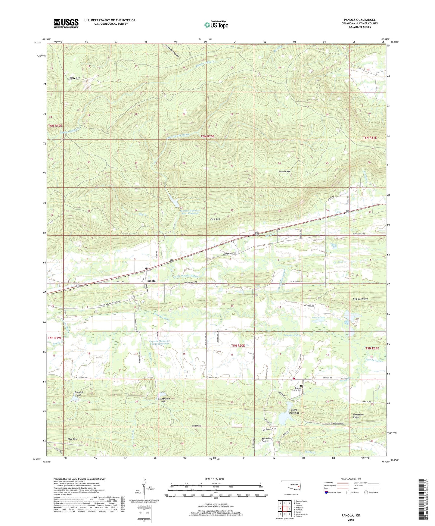
2022 topographic map quadrangle Panola in the state of Oklahoma. Scale: 1:24000. Based on the newly updated USGS 7.5' US Topo map series, this map is in the following counties: Latimer. The map contains contour data, water features, and other items you are used to seeing on USGS maps, but also has updated roads and other features. This is the next generation of topographic maps. Printed on high-quality waterproof paper with UV fade-resistant inks.
Quads adjacent to this one:
West: Wilburton
Northwest: Quinton South
North: Kinta
Northeast: Lequire
East: Red Oak
Southeast: Talihina
South: Baker Mountain
Southwest: Damon
This map covers the same area as the classic USGS quad with code o34095h2.
Contains the following named places: Austin Lake, Baldwin Cemetery, Baldwin Prairie, Bandy Creek, Brown Prairie Cemetery, Buzzard Gap, Clear Creek, Courthouse Gap, Cravens Church, Cravens Volunteer Fire Department, Dry Creek, First Mountain, Fourche Maline Creek Site 1 Dam, Fourche Maline Creek Site 1 Reservoir, Fourche Maline Creek Site 10 Dam, Fourche Maline Creek Site 10 Reservoir, Fourche Maline Creek Site 11 Dam, Fourche Maline Creek Site 11 Reservoir, Fourche Maline Creek Site 9 Dam, Fourche Maline Creek Site 9 Reservoir, Horse Creek, Limestone Ridge, Little Fourche Maline, Oknoname 077001 Dam, Oknoname 077001 Reservoir, Oknoname 077003 Dam, Oknoname 077003 Reservoir, Panola, Panola Census Designated Place, Panola Elementary School, Panola High School, Panola Post Office, Rocky Point Church, Second Mountain, Spring Creek, Spring Creek Gap, Yancy Mountain