MyTopo
Reed Oklahoma US Topo Map
Couldn't load pickup availability
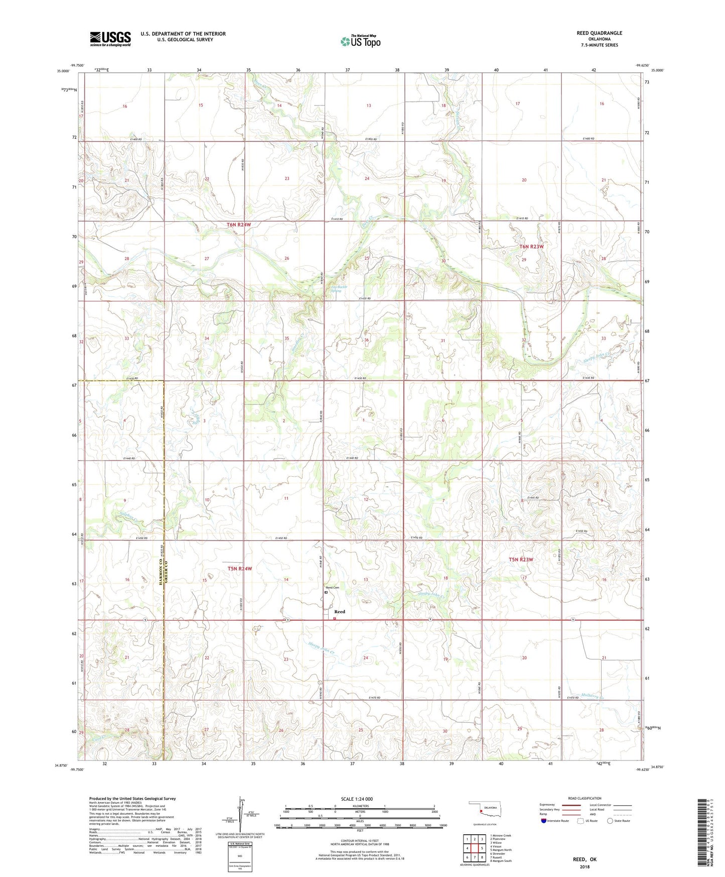
2018 topographic map quadrangle Reed in the state of Oklahoma. Scale: 1:24000. Based on the newly updated USGS 7.5' US Topo map series, this map is in the following counties: Greer, Harmon. The map contains contour data, water features, and other items you are used to seeing on USGS maps, but also has updated roads and other features. This is the next generation of topographic maps. Printed on high-quality waterproof paper with UV fade-resistant inks.
Quads adjacent to this one:
West: Vinson
Northwest: Minnow Creek
North: Plainview
Northeast: Willow
East: Mangum North
Southeast: Mangum South
South: Russell
Southwest: Shrewder
Contains the following named places: Deer Creek, Jay Buckle Spring, Kenneth Houck Dam, Kenneth Houck Reservoir, Reed, Reed Cemetery, Reed Church, Reed Volunteer Fire Department, Smedley Creek, Station Creek, Sulphur Church, Sulphur Creek, Township of Bloomington