MyTopo
Ringling Oklahoma US Topo Map
Couldn't load pickup availability
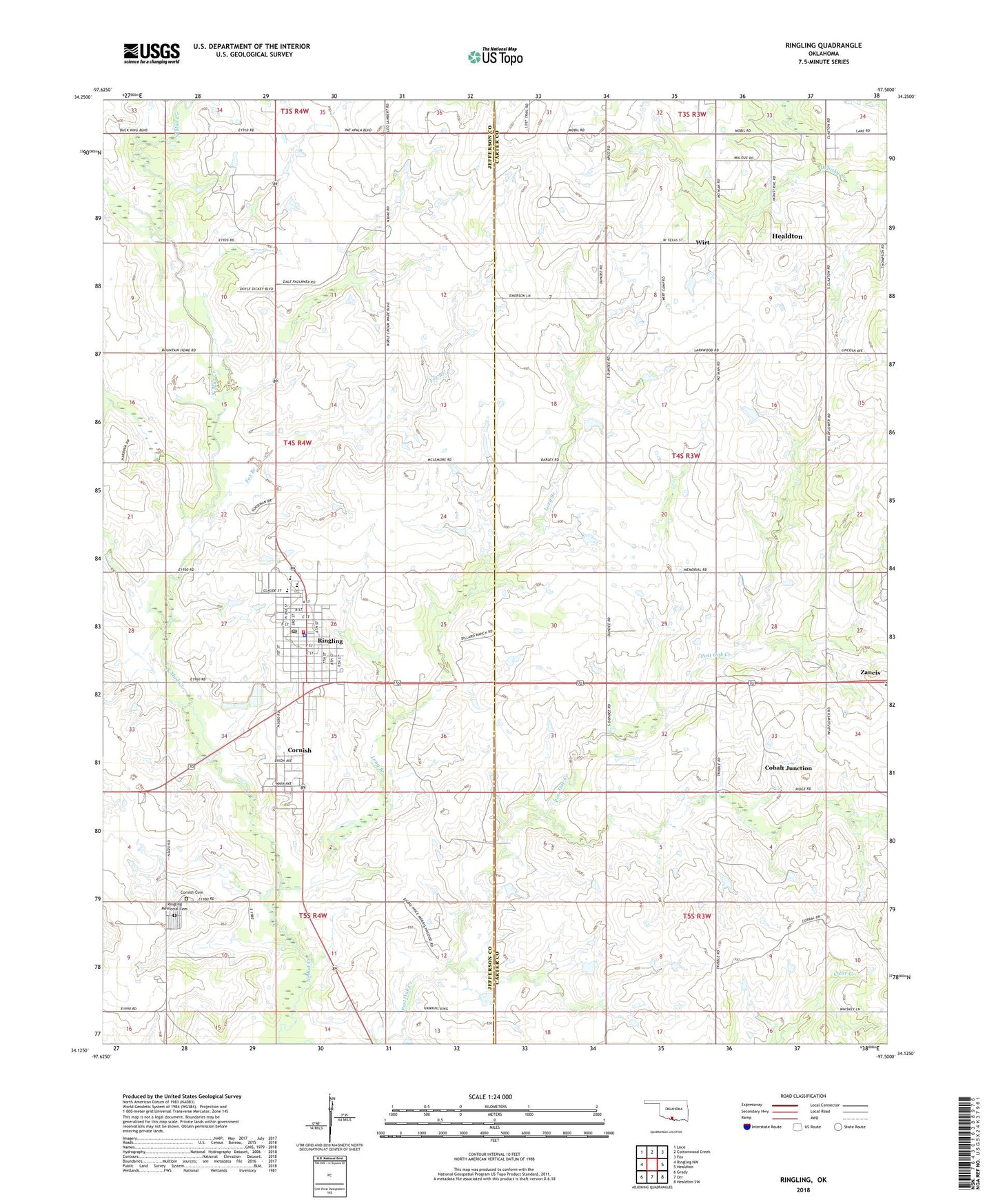
2018 topographic map quadrangle Ringling in the state of Oklahoma. Scale: 1:24000. Based on the newly updated USGS 7.5' US Topo map series, this map is in the following counties: Jefferson, Carter. The map contains contour data, water features, and other items you are used to seeing on USGS maps, but also has updated roads and other features. This is the next generation of topographic maps. Printed on high-quality waterproof paper with UV fade-resistant inks.
Quads adjacent to this one:
West: Ringling NW
Northwest: Loco
North: Cottonwood Creek
Northeast: Fox
East: Healdton
Southeast: Healdton SW
South: Orr
Southwest: Grady
Contains the following named places: Cobalt Junction, Cornish, Cornish Cemetery, Dundee, Fox Branch, Healdton Central Division, Long Branch, Ringling, Ringling Elementary School, Ringling Fire Department, Ringling High School, Ringling Junior High School, Ringling Memorial Cemetery, Ringling Police Department, Ringling Post Office, Town of Cornish, Town of Ringling, Wirt, Zaneis Elementary School