MyTopo
Fox Oklahoma US Topo Map
Couldn't load pickup availability
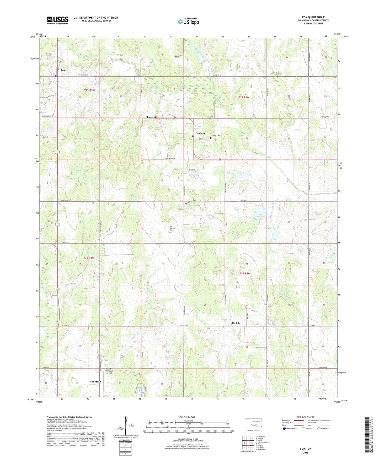
2022 topographic map quadrangle Fox in the state of Oklahoma. Scale: 1:24000. Based on the newly updated USGS 7.5' US Topo map series, this map is in the following counties: Carter. The map contains contour data, water features, and other items you are used to seeing on USGS maps, but also has updated roads and other features. This is the next generation of topographic maps. Printed on high-quality waterproof paper with UV fade-resistant inks.
Quads adjacent to this one:
West: Cottonwood Creek
Northwest: Ratliff City
North: Tatums
Northeast: Fox NE
East: Milo
Southeast: Lone Grove
South: Healdton
Southwest: Ringling
This map covers the same area as the classic USGS quad with code o34097c4.
Contains the following named places: Bear Creek, Briar Branch, Caddo Creek Site 22 Dam, Caddo Creek Site 22 Reservoir, Caddo Creek Site 23 Dam, Caddo Creek Site 23 Reservoir, Caddo Creek Site 24 Dam, Caddo Creek Site 24 Reservoir, Caddo Creek Site 25 Dam, Caddo Creek Site 25 Reservoir, Caddo Creek Site 3 Dam, Caddo Creek Site 3 Reservoir, Caddo Creek Site 6 Dam, Caddo Creek Site 6 Reservoir, Clemscott, Flag Branch, Fox, Fox Census Designated Place, Fox Elementary School, Fox Graham Volunteer Fire Department, Fox Junior - Senior High School, Fox Post Office, Graham, Graham Cemetery, Graham Post Office, Healdton Municipal Airport, Hug-me-tight Branch, Midway Church, Oil City, Oil Springs Cemetery, Old Scott, Red Branch, Russell Pretty Branch, Southerland Well Service Company, Tar Branch, ZIP Code: 73437