MyTopo
Rocky Creek Oklahoma US Topo Map
Couldn't load pickup availability
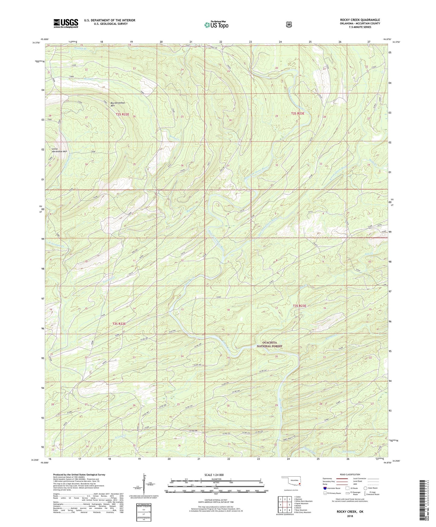
2018 topographic map quadrangle Rocky Creek in the state of Oklahoma. Scale: 1:24000. Based on the newly updated USGS 7.5' US Topo map series, this map is in the following counties: McCurtain. The map contains contour data, water features, and other items you are used to seeing on USGS maps, but also has updated roads and other features. This is the next generation of topographic maps. Printed on high-quality waterproof paper with UV fade-resistant inks.
Quads adjacent to this one:
West: Signal Mountain
Northwest: Clebit
North: Battiest
Northeast: White Rock Mountain
East: Bethel
Southeast: Old Glory Mountain
South: Bear Mountain
Southwest: Alikchi
Contains the following named places: Beeman Creek, Bethel Hill Church, Big Horseshoe Mountain, East Fork Glover River, East Terrapin Creek, Little Horseshoe Mountain, Pine Creek, Rocky Creek, West Fork Glover River, Willis Creek