MyTopo
Alikchi Oklahoma US Topo Map
Couldn't load pickup availability
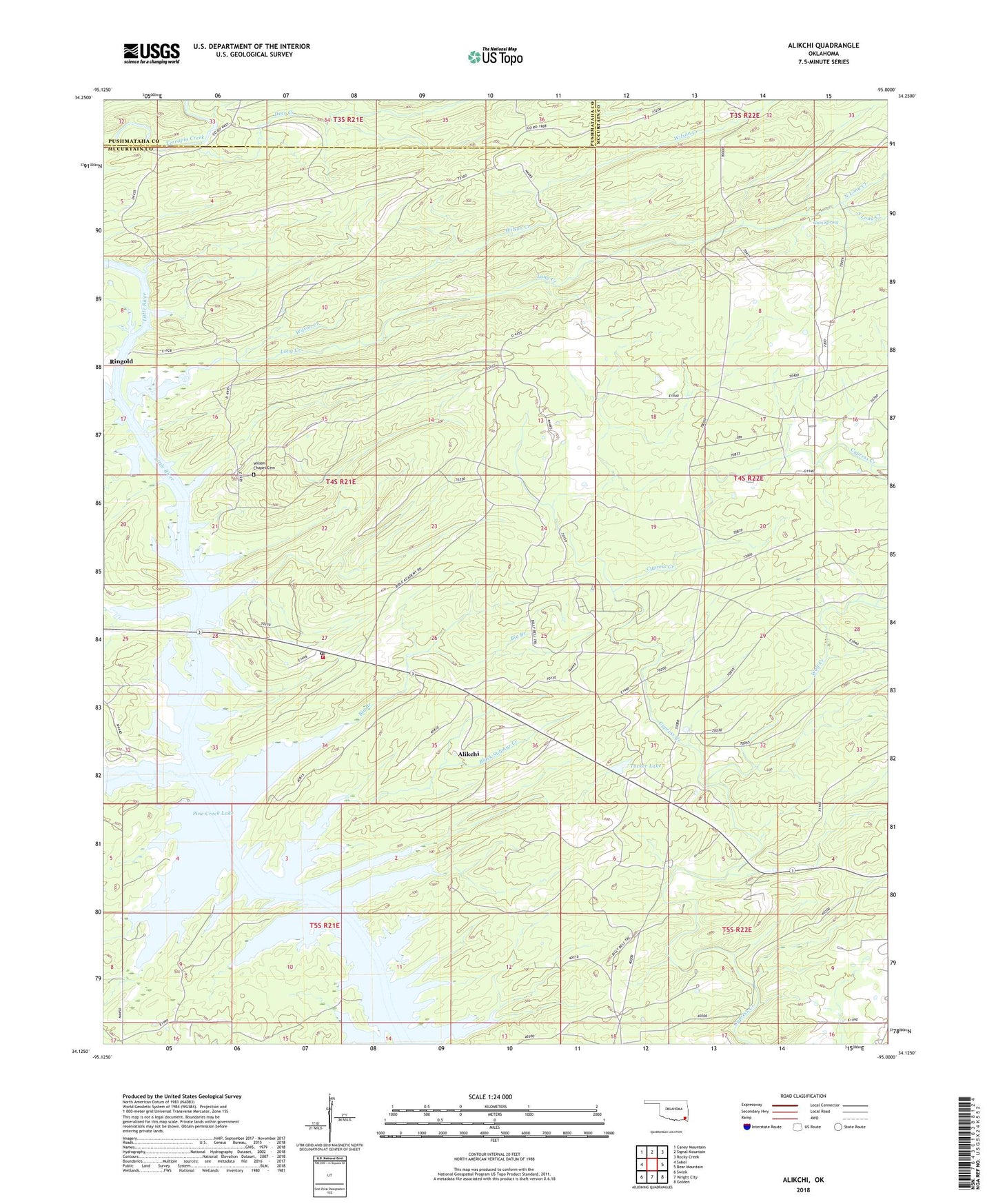
2022 topographic map quadrangle Alikchi in the state of Oklahoma. Scale: 1:24000. Based on the newly updated USGS 7.5' US Topo map series, this map is in the following counties: McCurtain, Pushmataha. The map contains contour data, water features, and other items you are used to seeing on USGS maps, but also has updated roads and other features. This is the next generation of topographic maps. Printed on high-quality waterproof paper with UV fade-resistant inks.
Quads adjacent to this one:
West: Sobol
Northwest: Caney Mountain
North: Signal Mountain
Northeast: Rocky Creek
East: Bear Mountain
Southeast: Golden
South: Wright City
Southwest: Swink
This map covers the same area as the classic USGS quad with code o34095b1.
Contains the following named places: Alikchi, Big Branch, Black Sulphur Creek, Deer Creek, Gum Spring, Little Wolf Creek, Long Creek, North Long Creek, Ringold Post Office, Ringold Volunteer Fire Department, Rock Creek, South Long Creek, Tucker Lake, Wilson Chapel Cemetery, Wilson Creek, Wolf Creek, Wright City Division, ZIP Code: 74755