MyTopo
Rocky Point Oklahoma US Topo Map
Couldn't load pickup availability
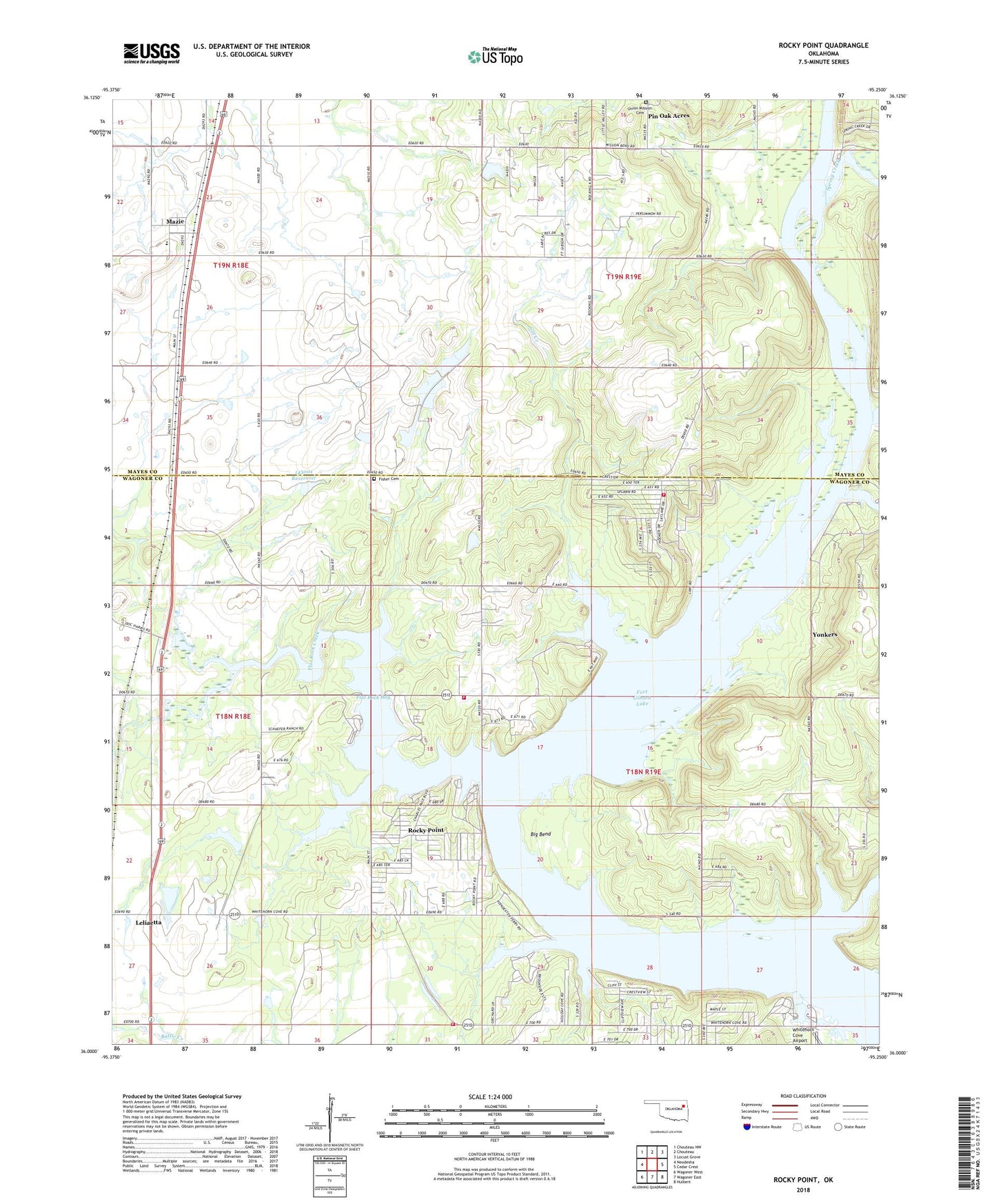
2018 topographic map quadrangle Rocky Point in the state of Oklahoma. Scale: 1:24000. Based on the newly updated USGS 7.5' US Topo map series, this map is in the following counties: Wagoner, Mayes. The map contains contour data, water features, and other items you are used to seeing on USGS maps, but also has updated roads and other features. This is the next generation of topographic maps. Printed on high-quality waterproof paper with UV fade-resistant inks.
Quads adjacent to this one:
West: Neodesha
Northwest: Chouteau NW
North: Chouteau
Northeast: Locust Grove
East: Cedar Crest
Southeast: Hulbert
South: Wagoner East
Southwest: Wagoner West
Contains the following named places: Big Bend, Big Hollow Creek, Blue Bill Point Public Use Area, Cat Creek, Fisher Cemetery, Flat Rock Bay, Flat Rock Creek, Flat Rock Creek Public Use Area, Flat Rock Fire Protection Association Station 1, Flat Rock Fire Protection Association Station 2, Jane Dennis Creek, Leliaetta, Mazie, Mazie Elementary School, Oknoname 145001 Dam, Oknoname 145001 Reservoir, Pin Oak Acres, Pin Oak Acres Census Designated Place, Rocky Point, Rocky Point Census Designated Place, Snug Harbor Public Use Area, Spring Creek, Three Fingers Bay Public Use Area, Township of Cherokee, Township of Mazie, Twin Oak Church, Union Mission Cemetery, Whitehorn Cove, Whitehorn Cove Public Use Area, Whitehorn Volunteer Fire Department, Yonkers, ZIP Code: 74477