MyTopo
Wagoner West Oklahoma US Topo Map
Couldn't load pickup availability
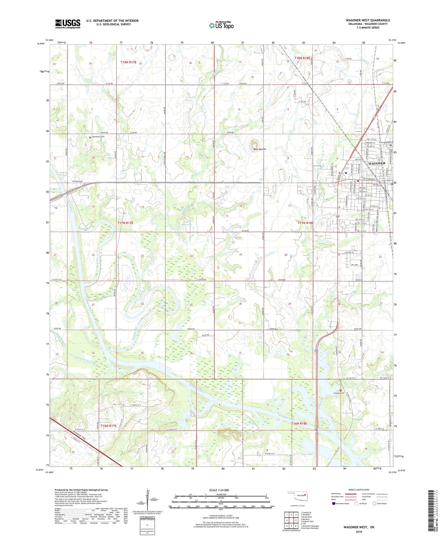
2022 topographic map quadrangle Wagoner West in the state of Oklahoma. Scale: 1:24000. Based on the newly updated USGS 7.5' US Topo map series, this map is in the following counties: Wagoner. The map contains contour data, water features, and other items you are used to seeing on USGS maps, but also has updated roads and other features. This is the next generation of topographic maps. Printed on high-quality waterproof paper with UV fade-resistant inks.
Quads adjacent to this one:
West: Red Bird
Northwest: Catoosa SE
North: Neodesha
Northeast: Rocky Point
East: Wagoner East
Southeast: Northeast Muskogee
South: Northwest Muskogee
Southwest: Taft
This map covers the same area as the classic USGS quad with code o35095h4.
Contains the following named places: Afton Landing Recreation Area, Billy Creek, Blue Mound, City of Wagoner, Coal Creek, Coal Creek Recreation Area, Elmwood Cemetery, First Presbyterian Church, Grayson Cemetery, KBIX-FM (Wagoner), KXTD-AM (Wagoner), Lincoln Academy, Oknoname 037018 Dam, Oknoname 037018 Reservoir, Port of Dunkin, Sandtown Cemetery, Sandtown Church, Star School, Strawberry Creek, Township of Blue Mound, Tullahassee Loop Recreation Area, Union Baptist Church, Vans Lake, Wagoner Community Hospital, Wagoner Emergency Medical Services, Wagoner Fire Department Station 1, Wagoner Post Office, Westwood Shopping Center, ZIP Code: 74467