MyTopo
Roll NE Oklahoma US Topo Map
Couldn't load pickup availability
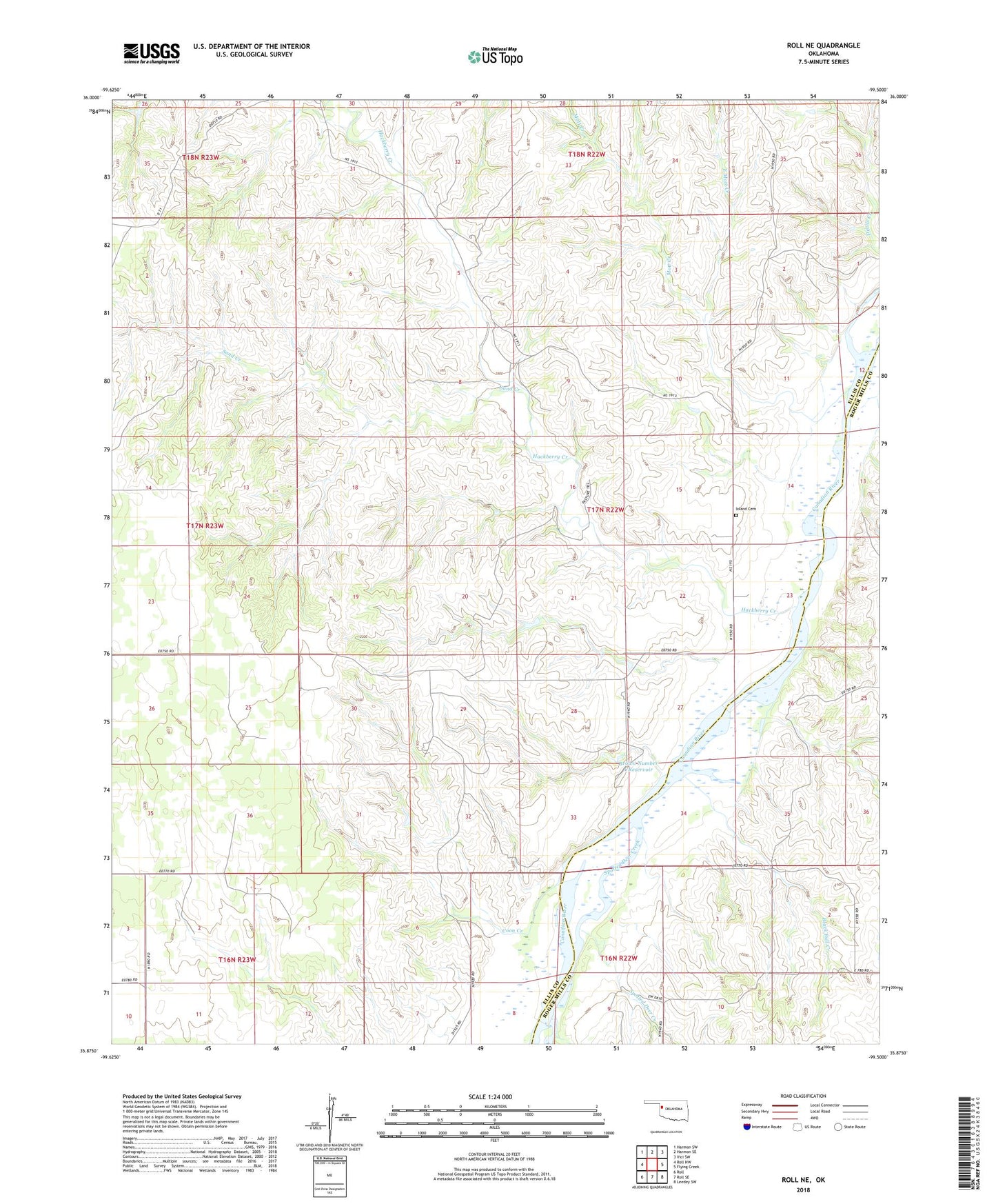
2018 topographic map quadrangle Roll NE in the state of Oklahoma. Scale: 1:24000. Based on the newly updated USGS 7.5' US Topo map series, this map is in the following counties: Ellis, Roger Mills. The map contains contour data, water features, and other items you are used to seeing on USGS maps, but also has updated roads and other features. This is the next generation of topographic maps. Printed on high-quality waterproof paper with UV fade-resistant inks.
Quads adjacent to this one:
West: Roll NW
Northwest: Harmon SW
North: Harmon SE
Northeast: Vici SW
East: Flying Creek
Southeast: Leedey SW
South: Roll SE
Southwest: Roll
Contains the following named places: Black Bull Creek, Brown Number 1 Dam, Brown Number 1 Reservoir, Coon Creek, East Mott Creek, Gillespie Number 1 Dam, Gillespie Number 1 Reservoir, Hackberry Creek, Ioland, Ioland Cemetery, Mott Creek, Nuttal Number 1 Dam, Nuttal Number 1 Reservoir, Sand Creek, Spotted Deer Creek, Township of Rawdon