MyTopo
Sasakwa Oklahoma US Topo Map
Couldn't load pickup availability
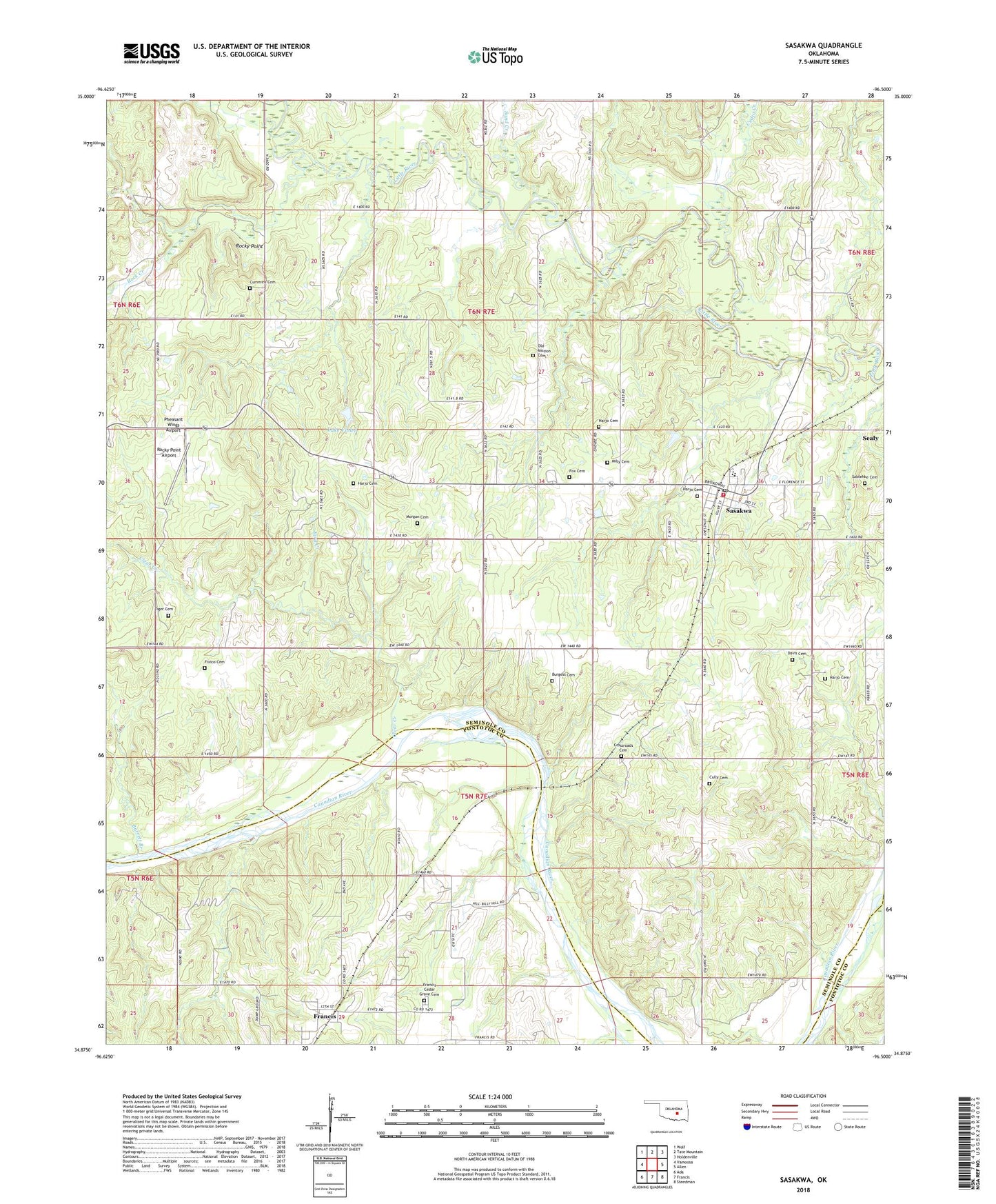
2022 topographic map quadrangle Sasakwa in the state of Oklahoma. Scale: 1:24000. Based on the newly updated USGS 7.5' US Topo map series, this map is in the following counties: Seminole, Pontotoc. The map contains contour data, water features, and other items you are used to seeing on USGS maps, but also has updated roads and other features. This is the next generation of topographic maps. Printed on high-quality waterproof paper with UV fade-resistant inks.
Quads adjacent to this one:
West: Vamoosa
Northwest: Wolf
North: Tate Mountain
Northeast: Holdenville
East: Allen
Southeast: Steedman
South: Francis
Southwest: Ada
This map covers the same area as the classic USGS quad with code o34096h5.
Contains the following named places: Barrett Branch, Bird Creek, Bird Creek Church, Burgess Cemetery, Cedar Grove Church, Cedar Grove School, Clear Creek, Cotton Creek, Crossroads Cemetery, Cudjo Creek, Cully Cemetery, Cummins Cemetery, Davis Cemetery, Fixico Cemetery, Fox Cemetery, Francis Cedar Grove Cemetery, Friendship Church, Gully School, Harjo Cemetery, Kight Church, Lake Violet, Lake Violet Dam, Milly Cemetery, Morgan Cemetery, Old Mission Cemetery, Pheasant Wings Airport, Rock Creek, Rocky Point, Rocky Point Airport, Saktehke Cemetery, Sand Creek, Sasakwa, Sasakwa Elementary School, Sasakwa High School, Sasakwa Post Office, Sasakwa Volunteer Fire Department, Sealy, Spring Church, Tiger Cemetery, Town of Sasakwa, Township of Miller, ZIP Code: 74867