MyTopo
Wolf Oklahoma US Topo Map
Couldn't load pickup availability
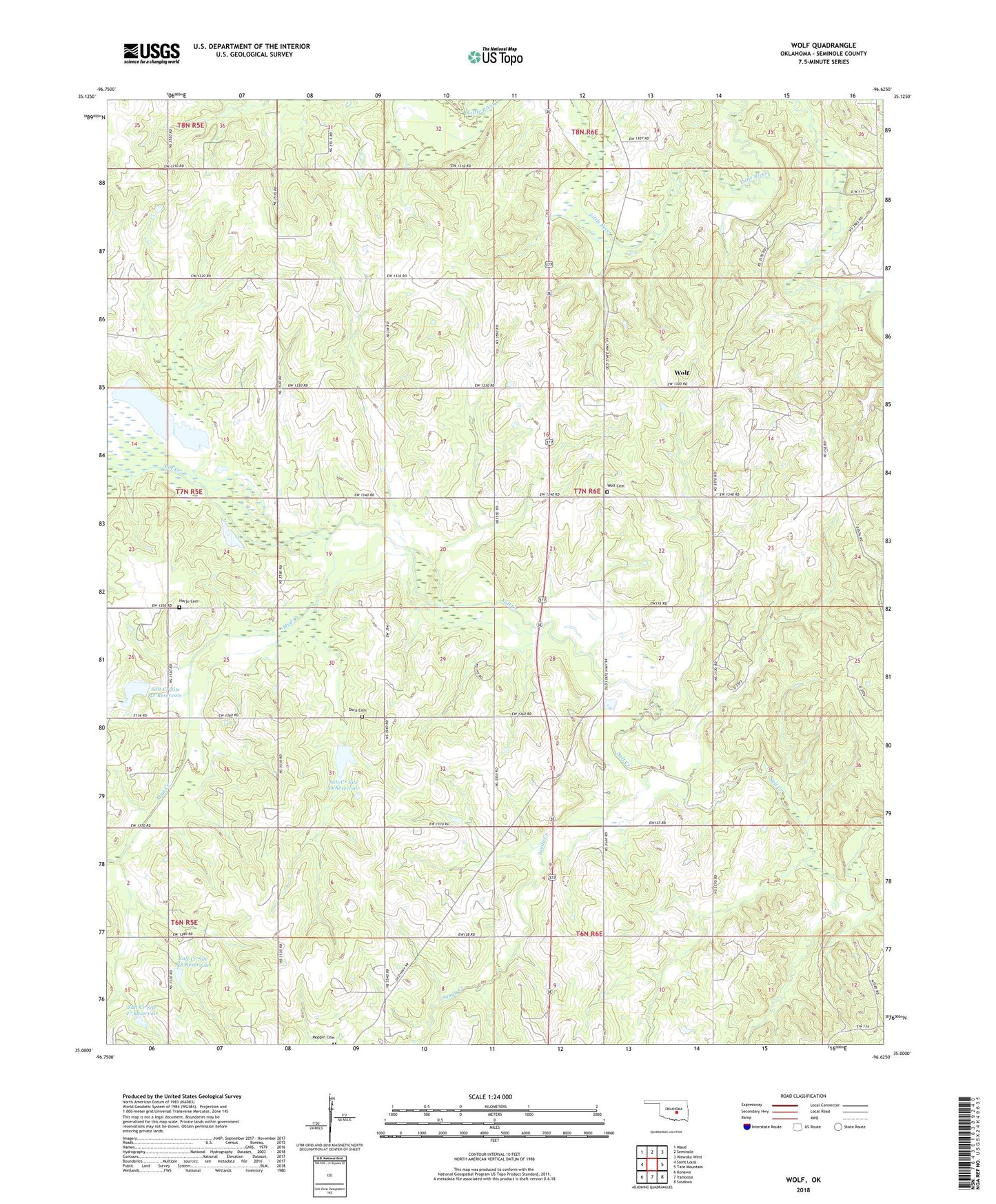
2022 topographic map quadrangle Wolf in the state of Oklahoma. Scale: 1:24000. Based on the newly updated USGS 7.5' US Topo map series, this map is in the following counties: Seminole. The map contains contour data, water features, and other items you are used to seeing on USGS maps, but also has updated roads and other features. This is the next generation of topographic maps. Printed on high-quality waterproof paper with UV fade-resistant inks.
Quads adjacent to this one:
West: Saint Louis
Northwest: Maud
North: Seminole
Northeast: Wewoka West
East: Tate Mountain
Southeast: Sasakwa
South: Vamoosa
Southwest: Konawa
This map covers the same area as the classic USGS quad with code o35096a6.
Contains the following named places: Achena Church, Cold Springs Church, Dora Cemetery, Eufaula Cedar Creek Church, Ishlum - Harjo Cemetery, Mud Creek, Salt Creek Site 42 Dam, Salt Creek Site 42 Reservoir, Salt Creek Site 47 Dam, Salt Creek Site 47 Reservoir, Salt Creek Site 48 Dam, Salt Creek Site 48 Reservoir, Salt Creek Site 49 Dam, Salt Creek Site 49 Reservoir, Sandy Creek, Seminole South Division, Township of Wolf, Wolf, Wolf Cemetery, ZIP Code: 74854