MyTopo
Savanna Oklahoma US Topo Map
Couldn't load pickup availability
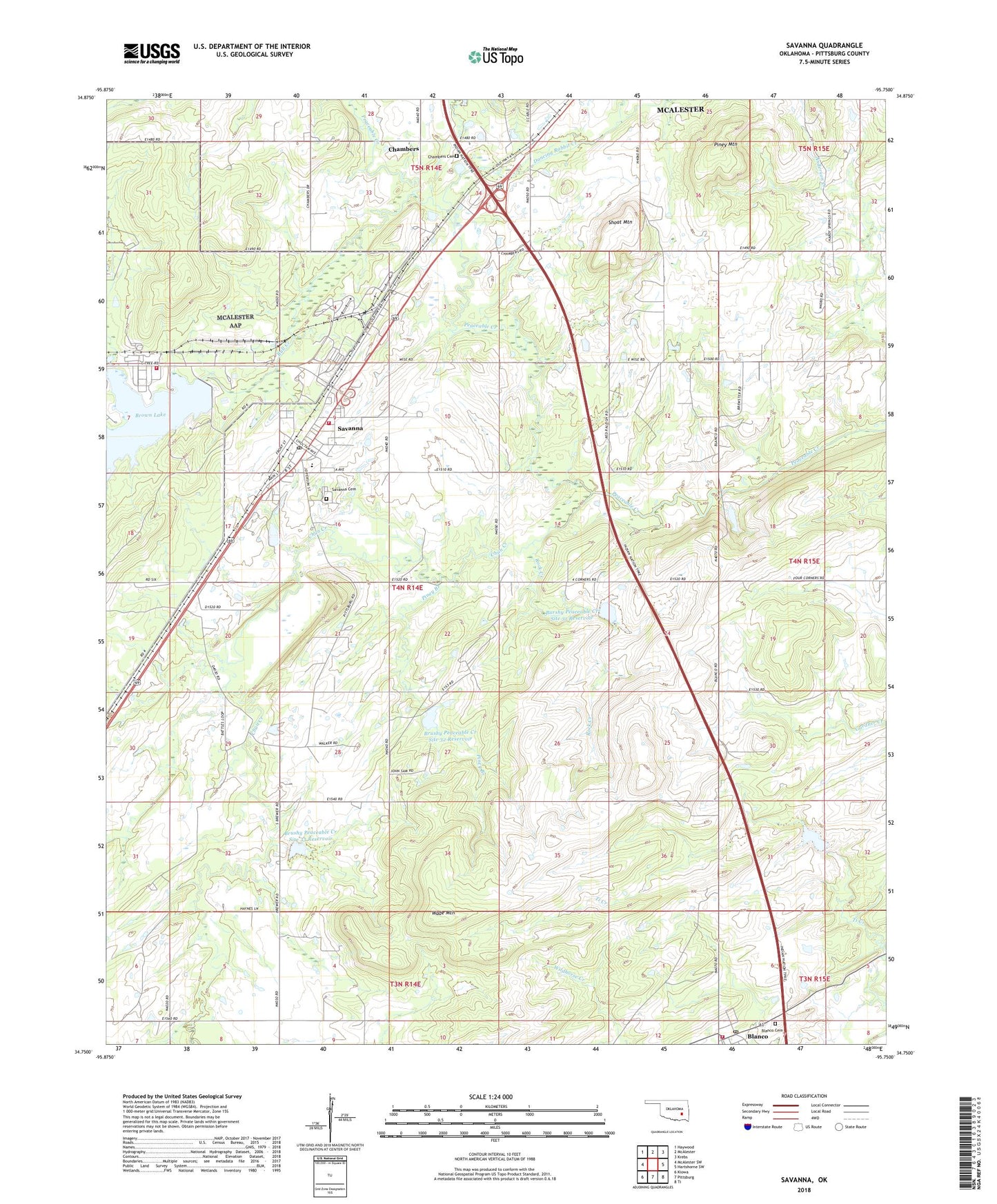
2018 topographic map quadrangle Savanna in the state of Oklahoma. Scale: 1:24000. Based on the newly updated USGS 7.5' US Topo map series, this map is in the following counties: Pittsburg. The map contains contour data, water features, and other items you are used to seeing on USGS maps, but also has updated roads and other features. This is the next generation of topographic maps. Printed on high-quality waterproof paper with UV fade-resistant inks.
Quads adjacent to this one:
West: McAlester SW
Northwest: Haywood
North: McAlester
Northeast: Krebs
East: Hartshorne SW
Southeast: Ti
South: Pittsburg
Southwest: Kiowa
Contains the following named places: Blanco, Blanco Cemetery, Blanco Census Designated Place, Blanco Fire Department, Blanco Post Office, Brewer, Brown Lake Dam, Brushy Peaceable Creek Site 31 Dam, Brushy Peaceable Creek Site 32 Dam, Brushy Peaceable Creek Site 32 Reservoir, Brushy Peaceable Creek Site 33 Dam, Brushy Peaceable Creek Site 33 Reservoir, Bull Creek, Burshy Peaceable Creek Site 31 Reservoir, Chambers, Chambers Cemetery, Chun Creek, Dancing Rabbit Creek, Halley, McAlester Army Ammo Plant Fire Department, Piney Branch, Piney Mountain, Rock Creek, Savanna, Savanna Cemetery, Savanna Elementary School, Savanna Fire Department, Savanna High School, Savanna Post Office, Shoat Mountain, Town of Savanna, Township of Savanna, Wade Mountain, ZIP Code: 74565