MyTopo
Kiowa Oklahoma US Topo Map
Couldn't load pickup availability
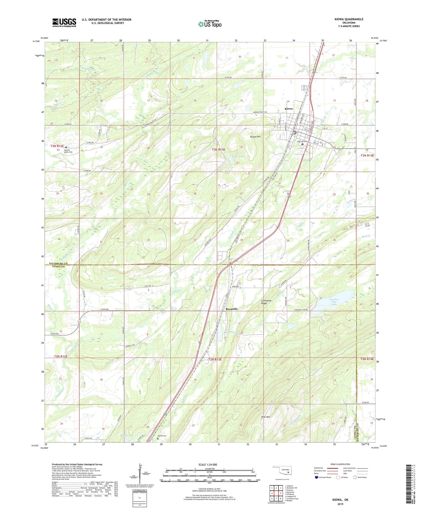
2022 topographic map quadrangle Kiowa in the state of Oklahoma. Scale: 1:24000. Based on the newly updated USGS 7.5' US Topo map series, this map is in the following counties: Pittsburg, Atoka. The map contains contour data, water features, and other items you are used to seeing on USGS maps, but also has updated roads and other features. This is the next generation of topographic maps. Printed on high-quality waterproof paper with UV fade-resistant inks.
Quads adjacent to this one:
West: Wardville
Northwest: Ashland
North: McAlester SW
Northeast: Savanna
East: Pittsburg
Southeast: Redden
South: Limestone Gap
Southwest: Coalgate SE
This map covers the same area as the classic USGS quad with code o34095f8.
Contains the following named places: Birch Creek, Country Club Lake, Country Club Lake Dam, Fivemile Creek, Harpers Valley Cemetery, Harpers Valley Church, Kiowa, Kiowa City Cemetery, Kiowa Elementary School, Kiowa High School, Kiowa Hill, Kiowa Lake, Kiowa Lake Dam, Kiowa Police Department, Kiowa Post Office, Kiowa Volunteer Fire Department, Kiowa-Pittsburg Division, Pine Mountain, Reynolds, Reynolds Lake, Rock Creek Site 14 Dam, Rock Creek Site 14 Reservoir, Sassafras Creek, Tanner Creek, Town of Kiowa, Township of Kiowa, Wards Cemetery, ZIP Code: 74553