MyTopo
Sperry Oklahoma US Topo Map
Couldn't load pickup availability
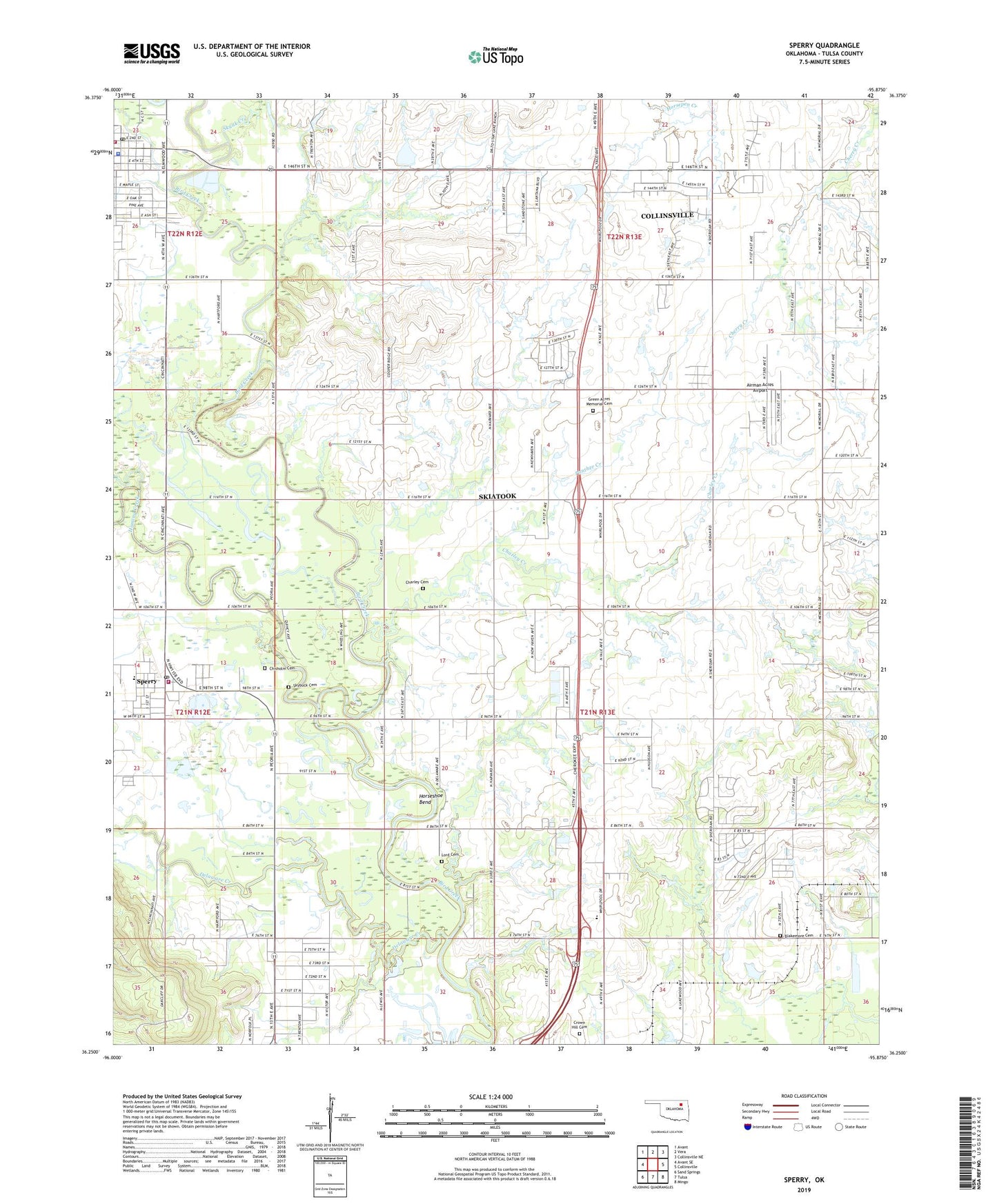
2019 topographic map quadrangle Sperry in the state of Oklahoma. Scale: 1:24000. Based on the newly updated USGS 7.5' US Topo map series, this map is in the following counties: Tulsa. The map contains contour data, water features, and other items you are used to seeing on USGS maps, but also has updated roads and other features. This is the next generation of topographic maps. Printed on high-quality waterproof paper with UV fade-resistant inks.
Quads adjacent to this one:
West: Avant SE
Northwest: Avant
North: Vera
Northeast: Collinsville NE
East: Collinsville
Southeast: Mingo
South: Tulsa
Southwest: Sand Springs
Contains the following named places: Airman Acres Airport, Barnes Elementary School, Blakemore Cemetery, Charley Cemetery, Charley Creek, Chisholm Cemetery, Cornerstone Christian Academy, Crown Hill Cemetery, Delaware Creek, Green Acres Memorial Cemetery, Hominy Creek, Horseshoe Bend, Immanuel Baptist Church, Krumme Oil Field, Lord Cemetery, Panther Creek, Skiatook Fire Department Station 1, Skiatook Police Department, Skiatook Post Office, Skunk Creek, Skybuck Cemetery, Sperry, Sperry Elementary School, Sperry High School, Sperry Middle School, Sperry Police Department, Sperry Post Office, Sperry Volunteer Fire Department, Town of Sperry, Township of Owasso, Township of Skiatook, Tulsa Non-Community