MyTopo
Avant SE Oklahoma US Topo Map
Couldn't load pickup availability
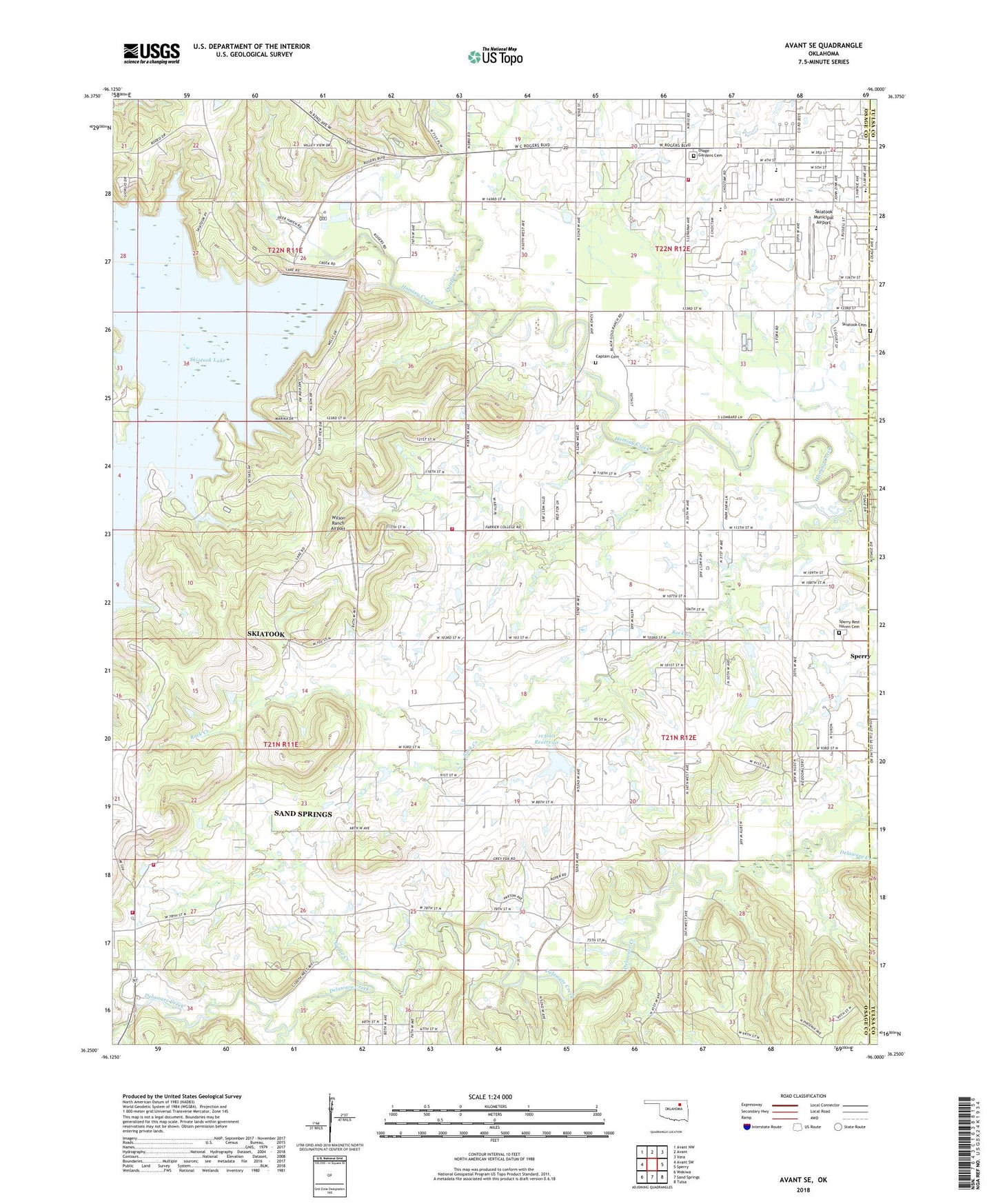
2022 topographic map quadrangle Avant SE in the state of Oklahoma. Scale: 1:24000. Based on the newly updated USGS 7.5' US Topo map series, this map is in the following counties: Osage, Tulsa. The map contains contour data, water features, and other items you are used to seeing on USGS maps, but also has updated roads and other features. This is the next generation of topographic maps. Printed on high-quality waterproof paper with UV fade-resistant inks.
Quads adjacent to this one:
West: Avant SW
Northwest: Avant NW
North: Avant
Northeast: Vera
East: Sperry
Southeast: Tulsa
South: Sand Springs
Southwest: Wekiwa
This map covers the same area as the classic USGS quad with code o36096c1.
Contains the following named places: Ascension Church, Captain Cemetery, City of Skiatook, Country Corner Fire Department, Dad Creek, Delaware Church, First Baptist Church, Goose Creek, Lakeview Southern Baptist Church, Lily Pad Lake, Marrs Elementary School, Newman Middle School, Oknoname 113001 Dam, Oknoname 113001 Reservoir, Osage Gardens Cemetery, Quapaw Creek, Rock Creek, Rock Fire Department Station 1, Rock School, Skiatook, Skiatook Cemetery, Skiatook Fire Department Station 2, Skiatook First Assembly of God, Skiatook High School, Skiatook Intermediate Elementary School, Skiatook Municipal Airport, Southeast Osage Division, Sperry Rest Haven Cemetery, Tall Chief Creek, Turkey Creek, United Methodist Church, Wilson Ranch Airport, Zink Fire Department, ZIP Code: 74073