MyTopo
Steedman Oklahoma US Topo Map
Couldn't load pickup availability
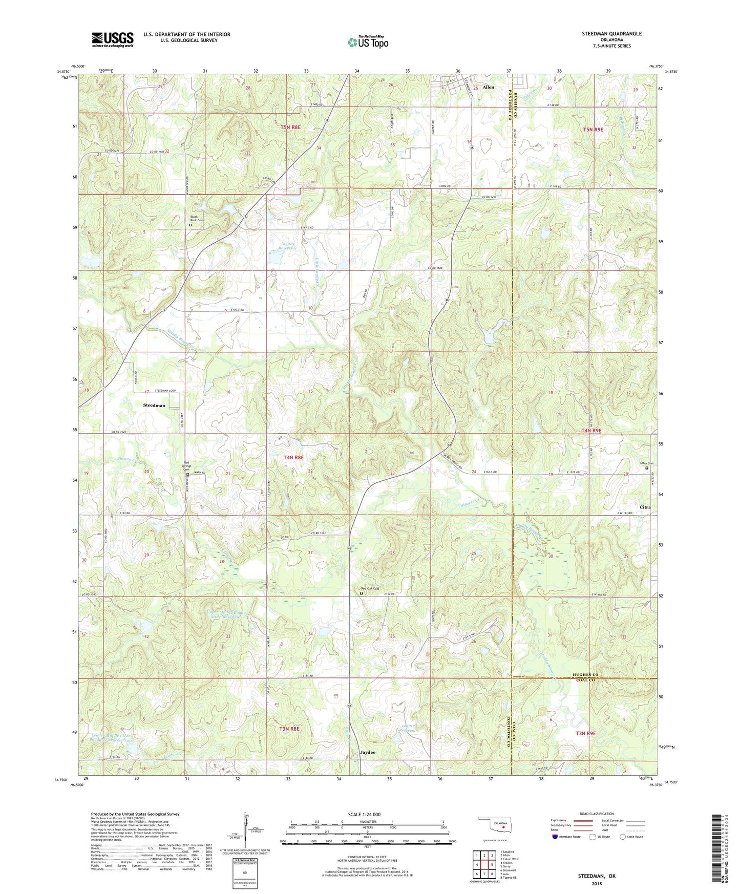
2018 topographic map quadrangle Steedman in the state of Oklahoma. Scale: 1:24000. Based on the newly updated USGS 7.5' US Topo map series, this map is in the following counties: Pontotoc, Hughes, Coal. The map contains contour data, water features, and other items you are used to seeing on USGS maps, but also has updated roads and other features. This is the next generation of topographic maps. Printed on high-quality waterproof paper with UV fade-resistant inks.
Quads adjacent to this one:
West: Francis
Northwest: Sasakwa
North: Allen
Northeast: Calvin West
East: Gerty
Southeast: Tupelo NE
South: Lula
Southwest: Stonewall
Contains the following named places: Allen Sportsman Dam, Allen Sportsman Lake, Billy Yardbrough Dam, Billy Yardbrough Reservoir, Black Rock Cemetery, Calvary Church, Citra, Citra Cemetery, Dawson Chapel, Earl Boyd Dam, Earl Boyd Reservoir, Hall Hill Church, Jaydee, Kalhoma Indian Reservation, Leader Middle Clear Boggy Creek 22 Dam, Leader Middle Clear Boggy Creek 22 Reservoir, Little Sandy Creek, Oknoname 123012 Dam, Oknoname 123012 Reservoir, Oknoname 123013 Dam, Oknoname 123013 Reservoir, Red Oak Cemetery, Red Oak Church, Red Springs Cemetery, Sincere Creek, Steedman, Town Branch, Township of Allen, Upper Muddy Boggy Site 6 Dam, Upper Muddy Boggy Site 6 Reservoir, ZIP Code: 74825