MyTopo
Gerty Oklahoma US Topo Map
Couldn't load pickup availability
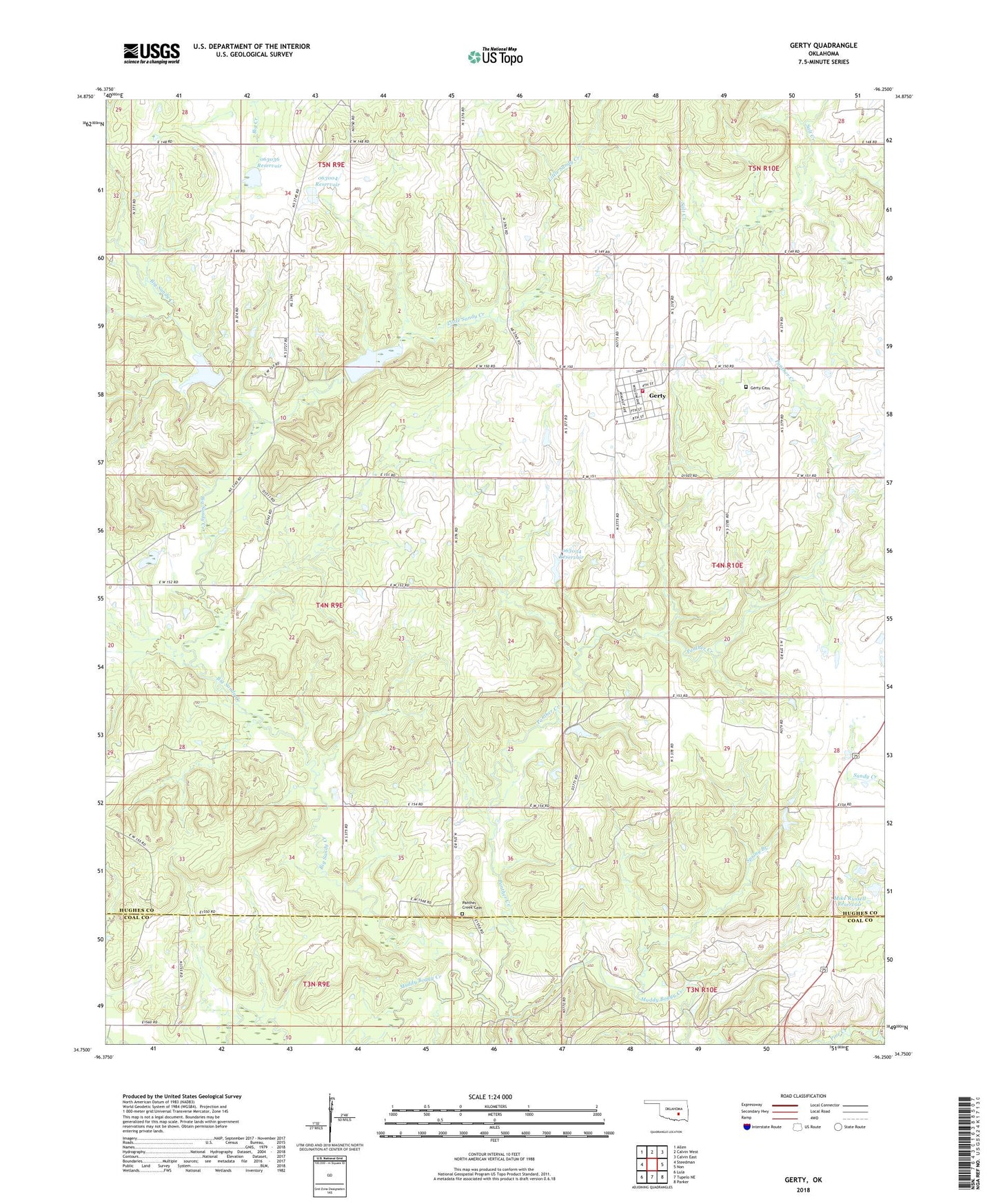
2022 topographic map quadrangle Gerty in the state of Oklahoma. Scale: 1:24000. Based on the newly updated USGS 7.5' US Topo map series, this map is in the following counties: Hughes, Coal. The map contains contour data, water features, and other items you are used to seeing on USGS maps, but also has updated roads and other features. This is the next generation of topographic maps. Printed on high-quality waterproof paper with UV fade-resistant inks.
Quads adjacent to this one:
West: Steedman
Northwest: Allen
North: Calvin West
Northeast: Calvin East
East: Non
Southeast: Parker
South: Tupelo NE
Southwest: Lula
This map covers the same area as the classic USGS quad with code o34096g3.
Contains the following named places: Big Sandy Creek, Gerty, Gerty Cemetery, Gerty Volunteer Fire Department, L J Shepard Dam, L J Shepard Reservoir, Little Sandy Creek, Mike Russell Dam, Mike Russell Reservoir, Ne Citra Oil and Gas Field, Oknoname 063004 Dam, Oknoname 063004 Reservoir, Oknoname 063034 Dam, Oknoname 063034 Reservoir, Oknoname 063036 Dam, Oknoname 063036 Reservoir, Panther Creek, Panther Creek Cemetery, Salt Creek Church, Spring Branch, Town of Gerty, Township of Newburg