MyTopo
Sweetwater Oklahoma US Topo Map
Couldn't load pickup availability
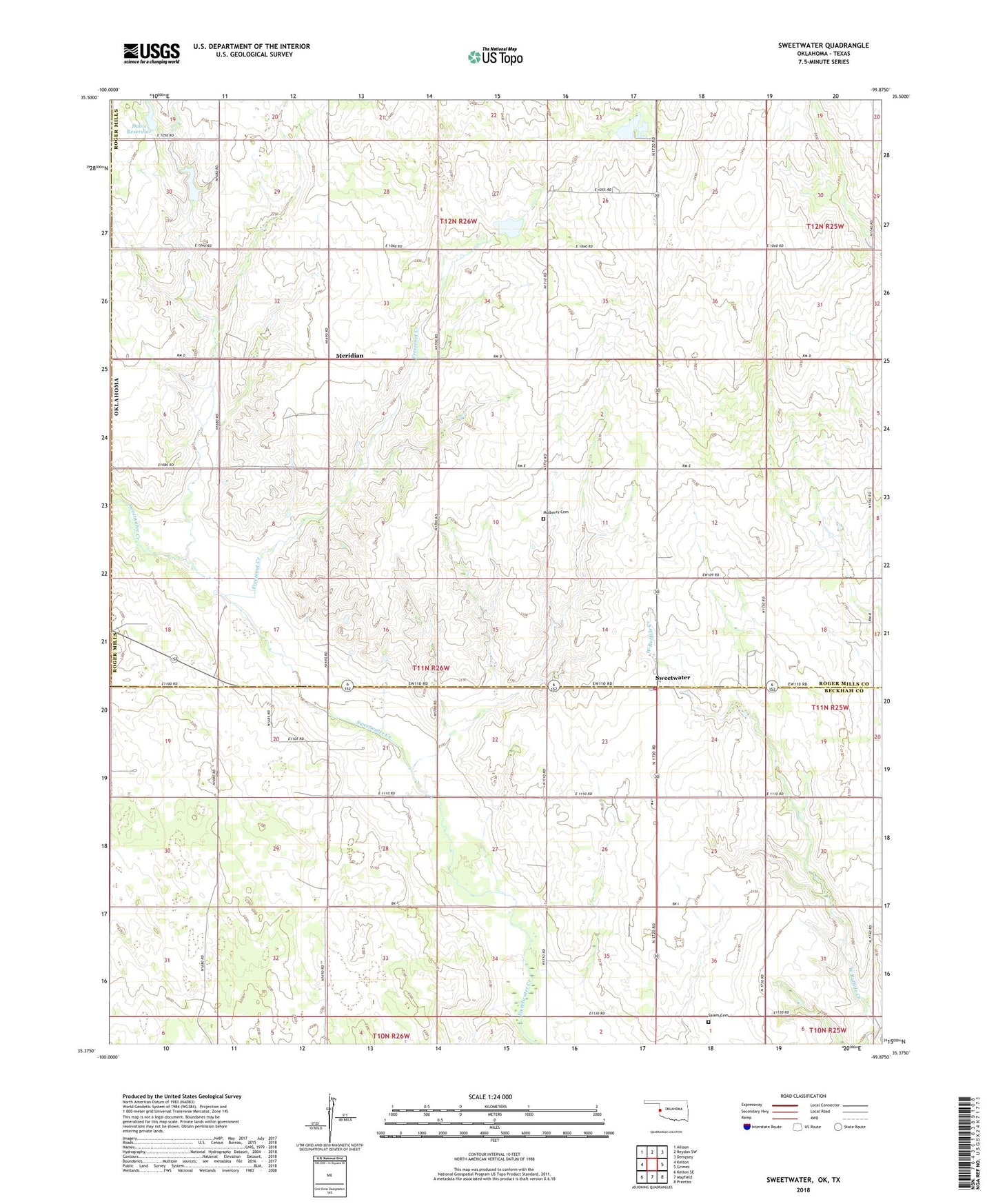
2018 topographic map quadrangle Sweetwater in the state of Oklahoma. Scale: 1:24000. Based on the newly updated USGS 7.5' US Topo map series, this map is in the following counties: Roger Mills, Beckham, Wheeler. The map contains contour data, water features, and other items you are used to seeing on USGS maps, but also has updated roads and other features. This is the next generation of topographic maps. Printed on high-quality waterproof paper with UV fade-resistant inks.
Quads adjacent to this one:
West: Kelton
Northwest: Allison
North: Reydon SW
Northeast: Dempsey
East: Grimes
Southeast: Prentiss
South: Mayfield
Southwest: Kelton SE
Contains the following named places: Assembly of God Church, Davis Number 1 Dam, Davis Number 2 Dam, Davis Number 2 Reservoir, Davis Reservoir, Freezeout Creek, Meridian, Meridian Creek, Mulberry Cemetery, Salem Cemetery, Sweetwater, Sweetwater - Beckham County Fire Department, Sweetwater Elementary School, Sweetwater Gas Field, Sweetwater High School, Sweetwater NW Gas Field, Sweetwater Post Office, Sweetwater West Gas Field, Town of Sweetwater, Township of Meridian, ZIP Code: 73666