MyTopo
Prentiss Oklahoma US Topo Map
Couldn't load pickup availability
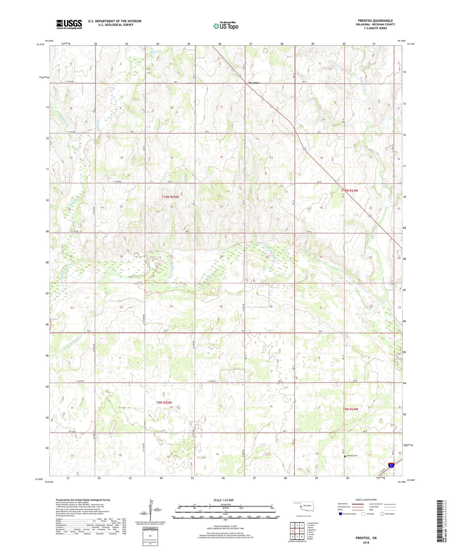
2022 topographic map quadrangle Prentiss in the state of Oklahoma. Scale: 1:24000. Based on the newly updated USGS 7.5' US Topo map series, this map is in the following counties: Beckham. The map contains contour data, water features, and other items you are used to seeing on USGS maps, but also has updated roads and other features. This is the next generation of topographic maps. Printed on high-quality waterproof paper with UV fade-resistant inks.
Quads adjacent to this one:
West: Mayfield
Northwest: Sweetwater
North: Grimes
Northeast: Berlin
East: Sayre
Southeast: Delhi
South: Erick
Southwest: Texola
This map covers the same area as the classic USGS quad with code o35099c7.
Contains the following named places: Buffalo Creek, Bulo Community Center, Cat Creek, Erick Gas Field, Gyp Creek Site 2 Dam, Gyp Creek Site 2 Reservoir, Little Turkey Creek, Mayfield NE Gas Field, Middle Buffalo Creek, New Liberty SW Gas Field, New Life Church, Pioneer Cemetery, Prentiss, Starvation Creek, West Buffalo Creek