MyTopo
Mayfield Oklahoma US Topo Map
Couldn't load pickup availability
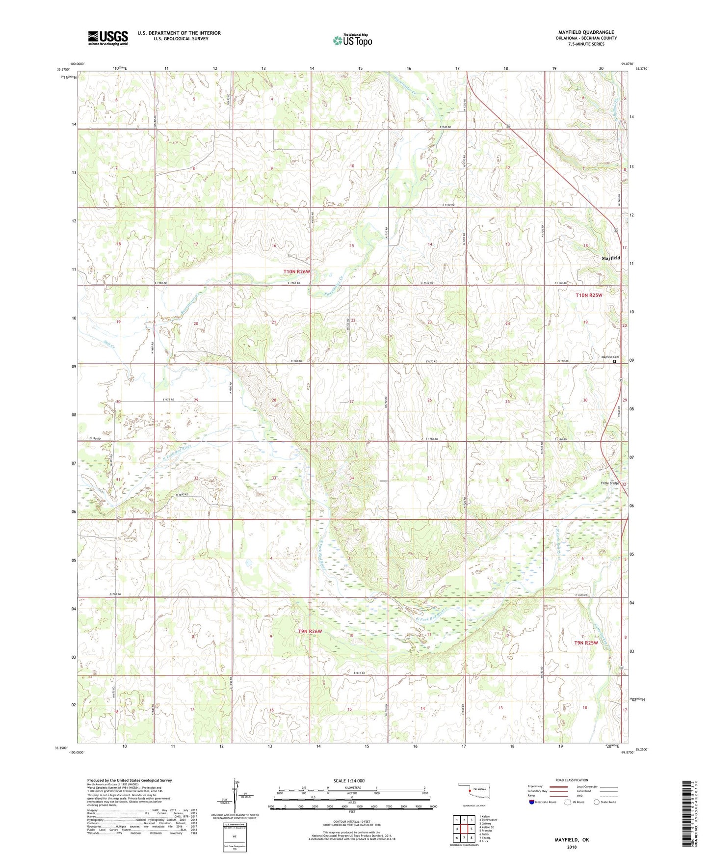
2022 topographic map quadrangle Mayfield in the state of Oklahoma. Scale: 1:24000. Based on the newly updated USGS 7.5' US Topo map series, this map is in the following counties: Beckham. The map contains contour data, water features, and other items you are used to seeing on USGS maps, but also has updated roads and other features. This is the next generation of topographic maps. Printed on high-quality waterproof paper with UV fade-resistant inks.
Quads adjacent to this one:
West: Kelton SE
Northwest: Kelton
North: Sweetwater
Northeast: Grimes
East: Prentiss
Southeast: Erick
South: Texola
Southwest: Fuller
Contains the following named places: Cow Creek Site 4 Dam, Cow Creek Site 4 Reservoir, Cow Creek Site 6 Dam, Cow Creek Site 6 Reservoir, Cow Creek Site 7 Dam, Cow Creek Site 7 Reservoir, Mayfield, Mayfield Cemetery, Salt Creek, Sweetwater Creek, Tittle Bridge, Township of Buffalo