MyTopo
Grimes Oklahoma US Topo Map
Couldn't load pickup availability
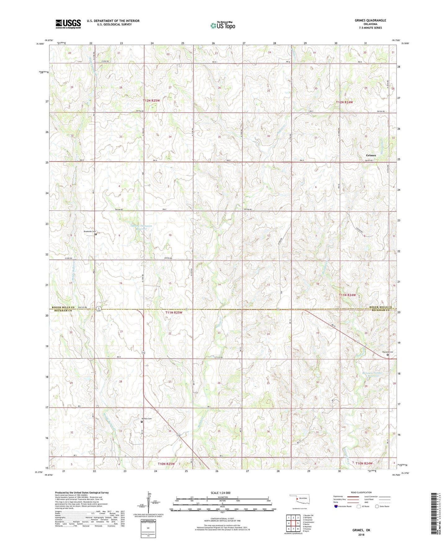
2022 topographic map quadrangle Grimes in the state of Oklahoma. Scale: 1:24000. Based on the newly updated USGS 7.5' US Topo map series, this map is in the following counties: Roger Mills, Beckham. The map contains contour data, water features, and other items you are used to seeing on USGS maps, but also has updated roads and other features. This is the next generation of topographic maps. Printed on high-quality waterproof paper with UV fade-resistant inks.
Quads adjacent to this one:
West: Sweetwater
Northwest: Reydon SW
North: Dempsey
Northeast: Cheyenne
East: Berlin
Southeast: Sayre
South: Prentiss
Southwest: Mayfield
This map covers the same area as the classic USGS quad with code o35099d7.
Contains the following named places: Brookside Cemetery, Buffalo Cemetery, Buffalo Church, Fuchs Dam, Fuchs Reservoir, Grimes, KVIJ-TV (Sayre), McLaury Number 2 Dam, McLaury Number 2 Reservoir, Oknoname 129009 Dam, Oknoname 129009 Reservoir, Shirley Thompson Dam, Shirley Thompson Reservoir, South Roger Mills Division, Sunny Point Community Center, Wayland Cemetery