MyTopo
Tailholt Oklahoma US Topo Map
Couldn't load pickup availability
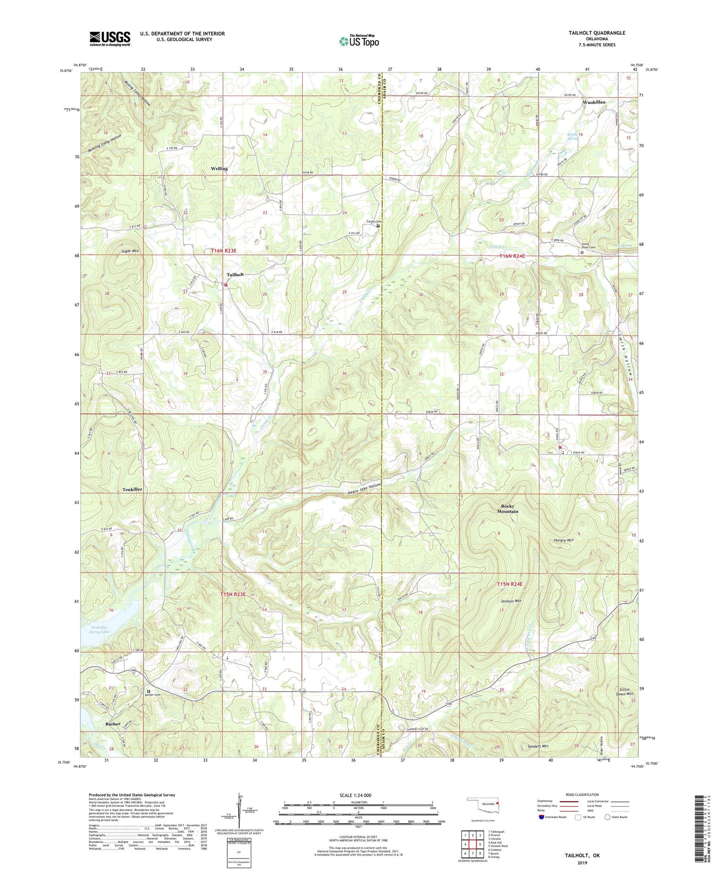
2019 topographic map quadrangle Tailholt in the state of Oklahoma. Scale: 1:24000. Based on the newly updated USGS 7.5' US Topo map series, this map is in the following counties: Cherokee, Adair. The map contains contour data, water features, and other items you are used to seeing on USGS maps, but also has updated roads and other features. This is the next generation of topographic maps. Printed on high-quality waterproof paper with UV fade-resistant inks.
Quads adjacent to this one:
West: Park Hill
Northwest: Tahlequah
North: Proctor
Northeast: Christie
East: Stilwell West
Southeast: Greasy
South: Bunch
Southwest: Cookson
Contains the following named places: Assembly Church, Barber, Barber Cemetery, Barber Census Designated Place, Barber Church, Bidding Creek, Bitting Spring, Caney Cemetery, Caney Census Designated Place, East Cherokee Division, Highway 100 West Volunteer Fire Department, Hungry Mountain, Independent Church, Indian Home Church, Jackson Mountain, July Spring, Negro Jake Hollow, North Fork Dry Creek, Rocky Mountain, Rocky Mountain Census Designated Place, Rocky Mountain School, Sanders Mountain, Smith Hollow, South Fork Dry Creek, Stony Point Cemetery, Sugar Mountain, Tailholt, Tenkiller, Tenkiller Census Designated Place, Tenkiller Elementary School, Township of Wauhillau, Wauhillau, Wauhillau Census Designated Place, Welling, Welling Tri - Community Fire Department Station 3, ZIP Code: 74471