MyTopo
Union Oklahoma US Topo Map
Couldn't load pickup availability
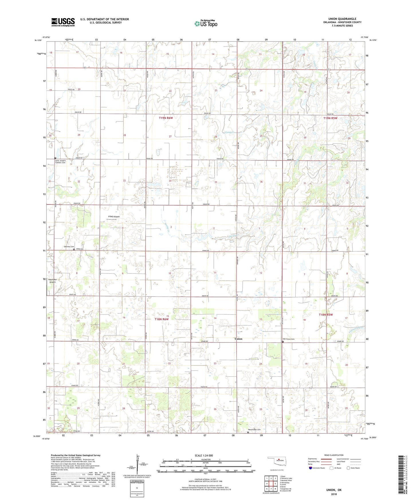
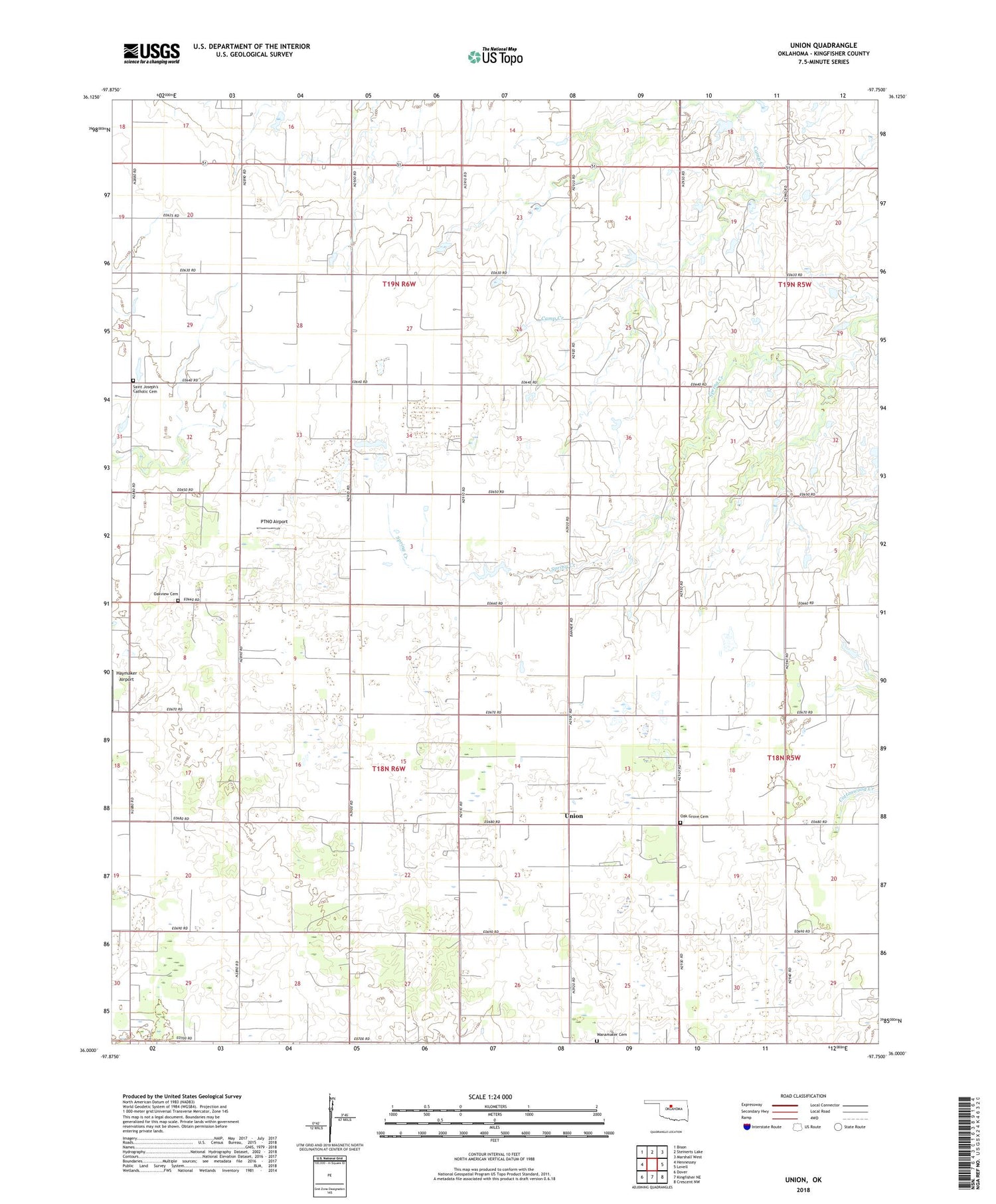
2018 topographic map quadrangle Union in the state of Oklahoma. Scale: 1:24000. Based on the newly updated USGS 7.5' US Topo map series, this map is in the following counties: Kingfisher. The map contains contour data, water features, and other items you are used to seeing on USGS maps, but also has updated roads and other features. This is the next generation of topographic maps. Printed on high-quality waterproof paper with UV fade-resistant inks.
Quads adjacent to this one:
West: Hennessey
Northwest: Bison
North: Steinerts Lake
Northeast: Marshall West
East: Lovell
Southeast: Crescent NW
South: Kingfisher NE
Southwest: Dover
Contains the following named places: Haymaker Airport, Nazarene Chapel, Nazarene Church, Oak Grove Cemetery, Oak Grove Church, Oakview Cemetery, PTNO Airport, Saint Joseph's Catholic Cemetery, Township of Sherman, Township of Union, Union, Wanamaker Cemetery, Wanamaker Church