MyTopo
Hennessey Oklahoma US Topo Map
Couldn't load pickup availability
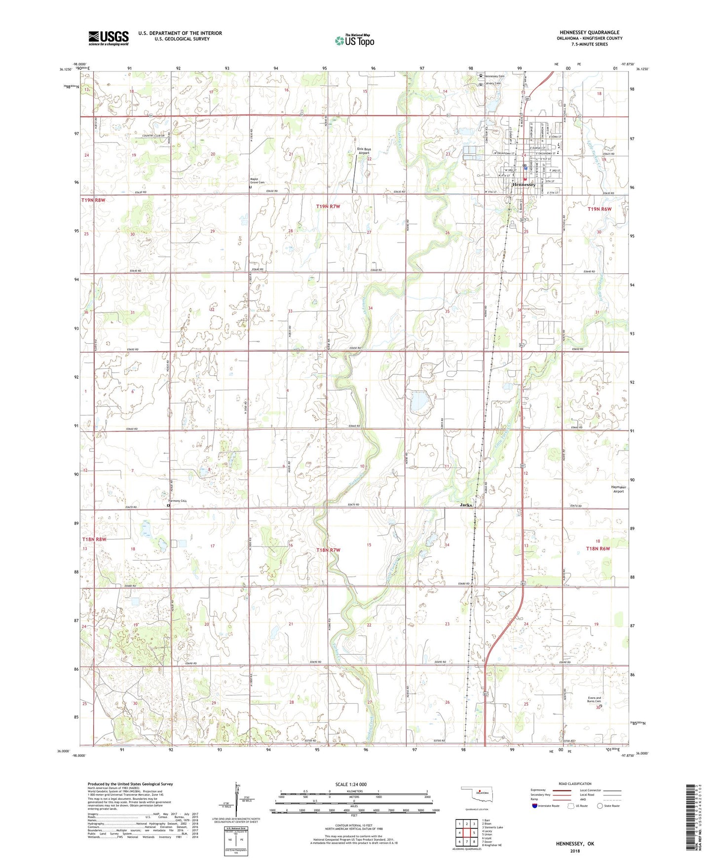
2022 topographic map quadrangle Hennessey in the state of Oklahoma. Scale: 1:24000. Based on the newly updated USGS 7.5' US Topo map series, this map is in the following counties: Kingfisher. The map contains contour data, water features, and other items you are used to seeing on USGS maps, but also has updated roads and other features. This is the next generation of topographic maps. Printed on high-quality waterproof paper with UV fade-resistant inks.
Quads adjacent to this one:
West: Lacey
Northwest: Barr
North: Bison
Northeast: Steinerts Lake
East: Union
Southeast: Kingfisher NE
South: Dover
Southwest: Loyal
This map covers the same area as the classic USGS quad with code o36097a8.
Contains the following named places: Assembly of God Church, Bullfoot Park, Calvary Cemetery, Catholic Church, Catholic Parish Hall, Church of Christ, Church of the Good News, Enix Boys Airport, Evans and Burns Cemetery, Harmony Cemetery, Harmony Church, Hennessey, Hennessey Cemetery, Hennessey Division, Hennessey High School, Hennessey Lower Elementary School, Hennessey Middle School, Hennessey Police Department, Hennessey Post Office, Hennessey Volunteer Fire Department, Jacks, Life Emergency Medical Services of Hennessey, Little Turkey Creek, Maple Grove Cemetery, Maple Grove Church, Methodist Church, Town of Hennessey, Township of Center, Woods Acres Airport, ZIP Code: 73742