MyTopo
Dover Oklahoma US Topo Map
Couldn't load pickup availability
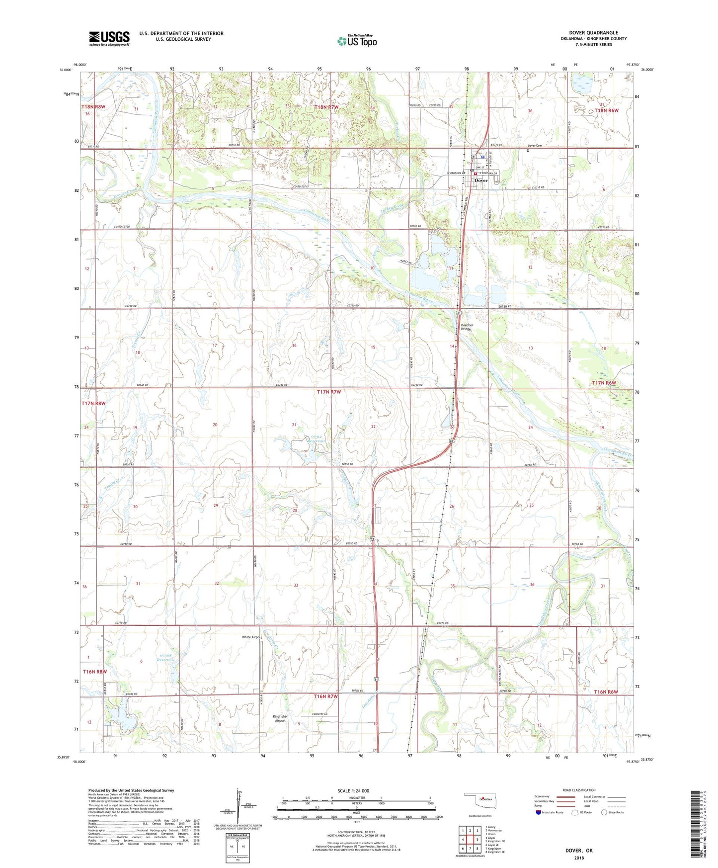
2022 topographic map quadrangle Dover in the state of Oklahoma. Scale: 1:24000. Based on the newly updated USGS 7.5' US Topo map series, this map is in the following counties: Kingfisher. The map contains contour data, water features, and other items you are used to seeing on USGS maps, but also has updated roads and other features. This is the next generation of topographic maps. Printed on high-quality waterproof paper with UV fade-resistant inks.
Quads adjacent to this one:
West: Loyal
Northwest: Lacey
North: Hennessey
Northeast: Union
East: Kingfisher NE
Southeast: Kingfisher SE
South: Kingfisher
Southwest: Loyal SE
This map covers the same area as the classic USGS quad with code o35097h8.
Contains the following named places: Boecher Bridge, Cooper Creek, Dover, Dover Cemetery, Dover Elementary School, Dover High School, Dover Police Department, Dover Post Office, Dover Volunteer Fire Department, Elmer Lake Dam, Kingfisher County, Kingfisher Creek, Lake Elmer, Lou Anna Creek, Oknoname 07308 Dam, Oknoname 07308 Reservoir, Oknoname 07312 Dam, Oknoname 07312 Reservoir, Oknoname 083028 Dam, Oknoname 083028 Reservoir, Town of Dover, Township of Cimarron, Trail Creek, Treaty Creek, Turkey Creek, White Airport