MyTopo
Vinson Oklahoma US Topo Map
Couldn't load pickup availability
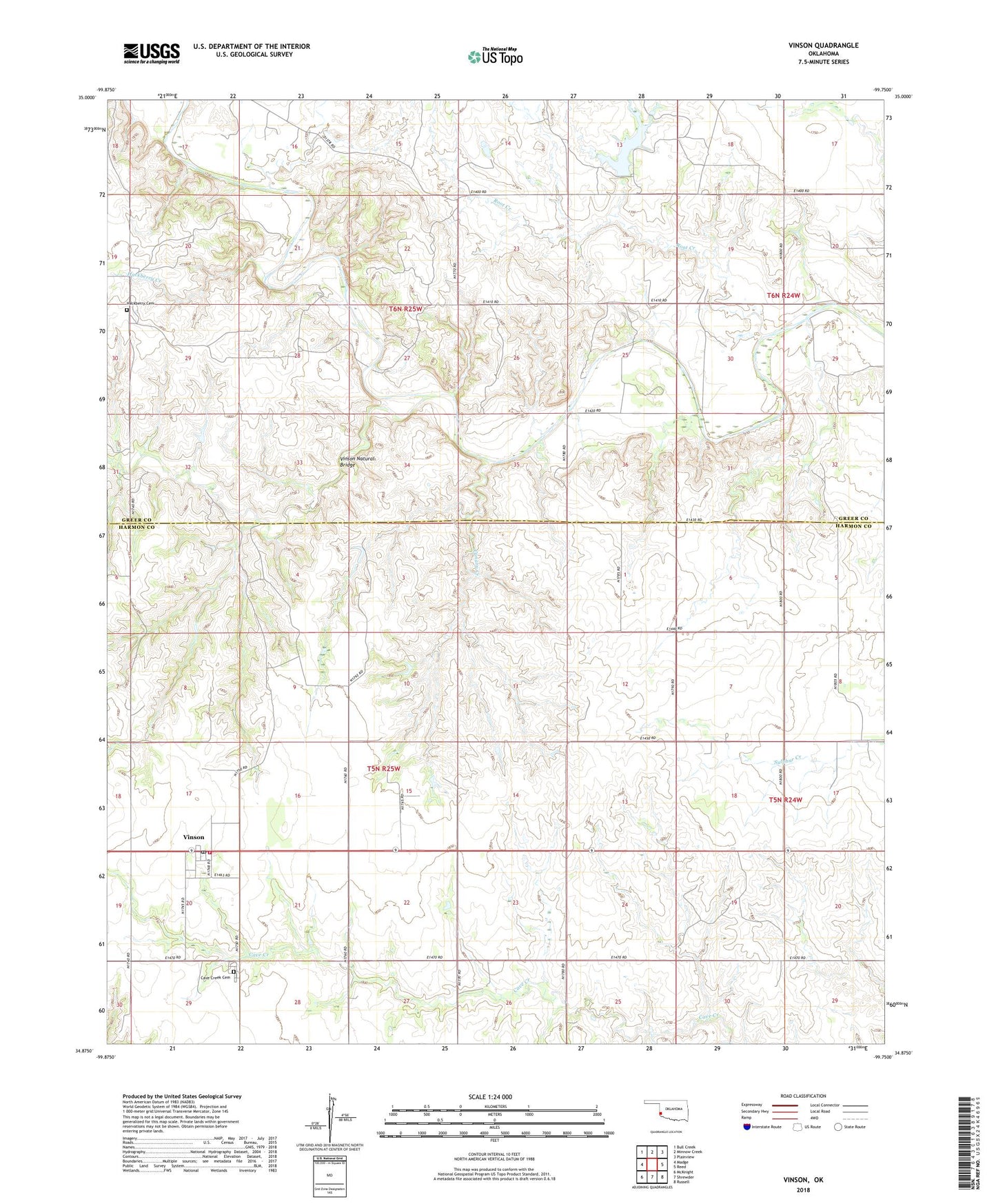
2018 topographic map quadrangle Vinson in the state of Oklahoma. Scale: 1:24000. Based on the newly updated USGS 7.5' US Topo map series, this map is in the following counties: Harmon, Greer. The map contains contour data, water features, and other items you are used to seeing on USGS maps, but also has updated roads and other features. This is the next generation of topographic maps. Printed on high-quality waterproof paper with UV fade-resistant inks.
Quads adjacent to this one:
West: Madge
Northwest: Bull Creek
North: Minnow Creek
Northeast: Plainview
East: Reed
Southeast: Russell
South: Shrewder
Southwest: McKnight
Contains the following named places: Canary Creek, Cave Creek Cemetery, Doc Hollis Lake, Grape Creek, Hackberry Cemetery, Hackberry Creek, Hollis 118 Dam, Hollis Division, J B Hollis Dam, J B Hollis Reservoir, Root Creek, Russell Overton Dam, Russell Overton Reservoir, Township of Francis, Township of Jester, Vinson, Vinson Natural Bridge, Vinson Post Office, Vinson Rural Volunteer Fire Department