MyTopo
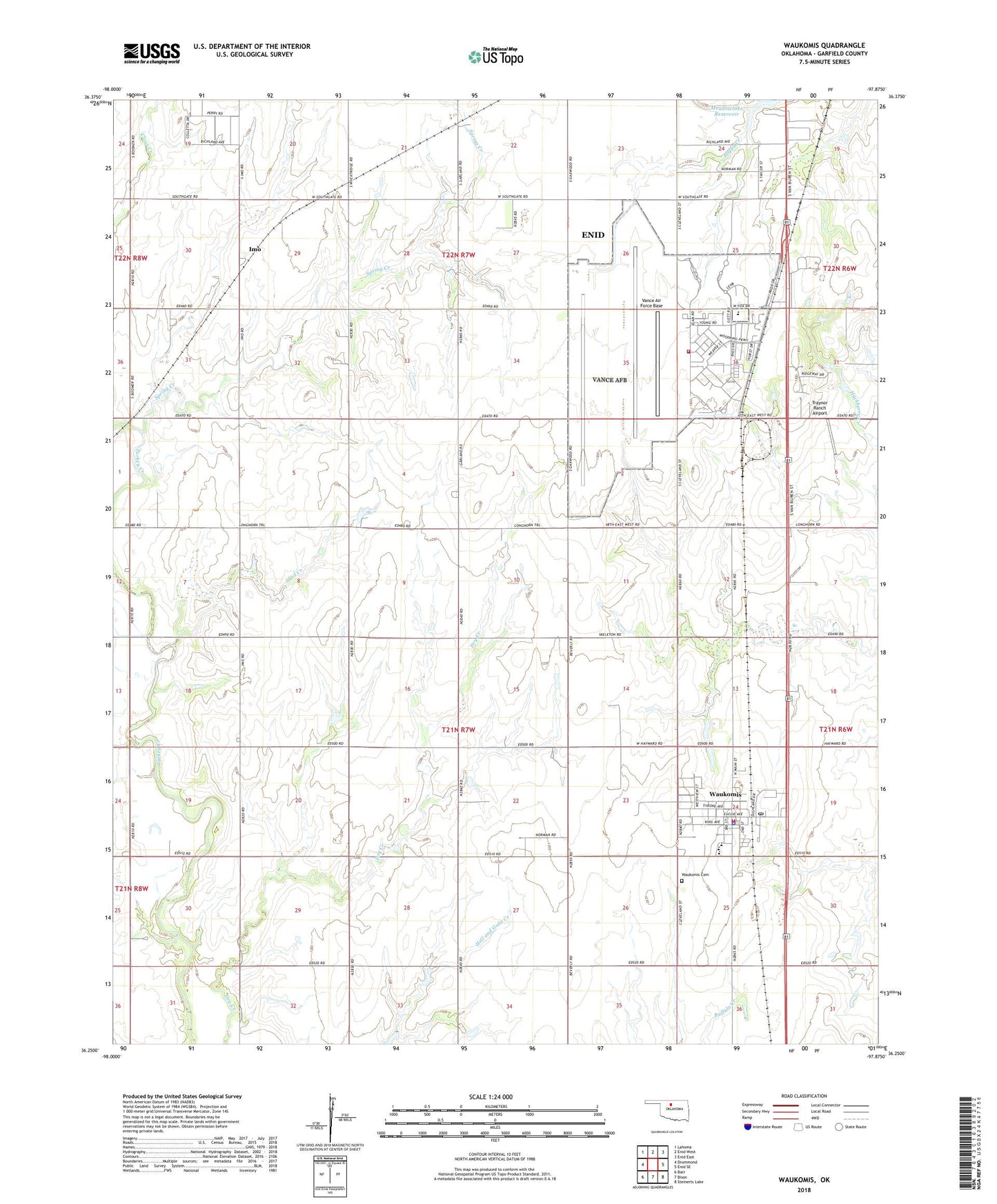
Waukomis Oklahoma US Topo Map
Couldn't load pickup availability
2018 topographic map quadrangle Waukomis in the state of Oklahoma. Scale: 1:24000. Based on the newly updated USGS 7.5' US Topo map series, this map is in the following counties: Garfield. The map contains contour data, water features, and other items you are used to seeing on USGS maps, but also has updated roads and other features. This is the next generation of topographic maps. Printed on high-quality waterproof paper with UV fade-resistant inks.
Quads adjacent to this one:
West: Drummond
Northwest: Lahoma
North: Enid West
Northeast: Enid East
East: Enid SE
Southeast: Steinerts Lake
South: Bison
Southwest: Barr
Contains the following named places: Anderson Landing Strip, Camp Rhodes, Eisenhower Elementary School, Happy Valley School, Highland School, Imo, Meadowlake Park, Meadowlake Reservoir, Sand Creek, Spring Creek, Sunnyside School, Town of Waukomis, Township of Garland, Township of Waukomis, Traynor Ranch Airport, Turkey Creek School, Vance Air Force Base, Vance Air Force Base Fire Department, Vance Park, Waukomis, Waukomis Baptist Church, Waukomis Cemetery, Waukomis Elementary School, Waukomis Fire Department, Waukomis High School, Waukomis Middle School, Waukomis Police Department, Waukomis Post Office, Waukomis United Methodist Church, ZIP Codes: 73705, 73773