MyTopo
Webbers Falls Oklahoma US Topo Map
Couldn't load pickup availability
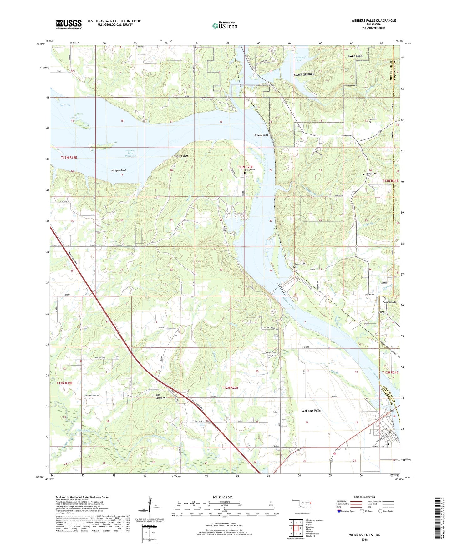
2018 topographic map quadrangle Webbers Falls in the state of Oklahoma. Scale: 1:24000. Based on the newly updated USGS 7.5' US Topo map series, this map is in the following counties: Muskogee, Sequoyah. The map contains contour data, water features, and other items you are used to seeing on USGS maps, but also has updated roads and other features. This is the next generation of topographic maps. Printed on high-quality waterproof paper with UV fade-resistant inks.
Quads adjacent to this one:
West: Keefton
Northwest: Southeast Muskogee
North: Braggs
Northeast: Qualls
East: Gore
Southeast: Stigler NE
South: Holt Mountain
Southwest: Warner
Contains the following named places: Arrowhead Point Public Use Area, Big Branch, Brewer Bend, Brewer Bend Park, Brewer Bend Public Use Area, Brewer Cemetery, Buckhorn Church, Buckhorn Volunteer Fire Department, Cedar Creek, Deep Branch, Dog Branch, First Baptist Church, Georges Fork, Greenleaf Creek, Greenleaf Lake Dam, Greenleaf Lake State Park, Horne Airport, House of Prayer, Hy 10 Landing, Little Greenleaf Creek, Milligan Bend, Mountain Grove Church, Muskogee Non-Community, Padgett Bluff, Phillips Cemetery, Plunkett Cemetery, Rock Dike Park, Salt Spring Mountain, Sam Cemetery, Sour John, Sour John Census Designated Place, Spaniard Creek, Sulphur Branch, Taylor Creek, Tiener Branch, Township of McLain, Vaught Cemetery, Webbers Falls, Webbers Falls Division, Webbers Falls High School, Webbers Falls Lock and Dam, Webbers Falls Lock and Dam 16, Webbers Falls Police Department, Webbers Falls Post Office, Webbers Falls Public Schools, Webbers Falls Volunteer Fire Department, White Cemetery, White Chapel