MyTopo
Warner Oklahoma US Topo Map
Couldn't load pickup availability
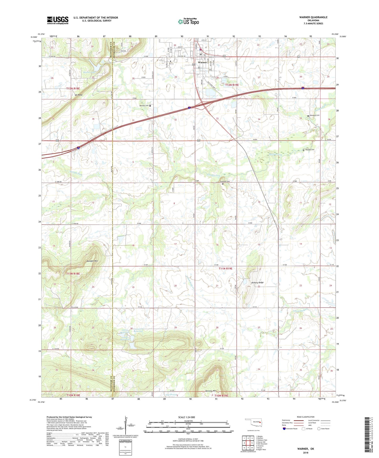
2022 topographic map quadrangle Warner in the state of Oklahoma. Scale: 1:24000. Based on the newly updated USGS 7.5' US Topo map series, this map is in the following counties: Muskogee, McIntosh. The map contains contour data, water features, and other items you are used to seeing on USGS maps, but also has updated roads and other features. This is the next generation of topographic maps. Printed on high-quality waterproof paper with UV fade-resistant inks.
Quads adjacent to this one:
West: Warner NW
Northwest: Oktaha
North: Keefton
Northeast: Webbers Falls
East: Holt Mountain
Southeast: Stigler West
South: Porum
Southwest: Texanna
This map covers the same area as the classic USGS quad with code o35095d3.
Contains the following named places: Bennett Cemetery, Conley School, Connors State College, Dunigan Mountain, Foreman Cemetery, Gap Prairie, Hickory Ridge, Howland Cemetery, Oknoname 101010 Dam, Oknoname 101010 Reservoir, Oknoname 101011 Dam, Oknoname 101011 Reservoir, Oknoname 101012 Dam, Oknoname 101012 Reservoir, Popes Chapel, Town of Warner, Warner, Warner Division, Warner Elementary / Middle School, Warner Lake, Warner Police Department, Warner Post Office, Warner Volunteer Fire Department, Woodall Cemetery, ZIP Code: 74469