MyTopo
Welch North Oklahoma US Topo Map
Couldn't load pickup availability
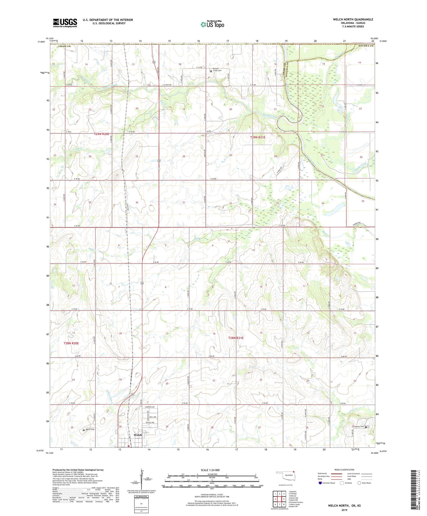
2019 topographic map quadrangle Welch North in the states of Oklahoma, Kansas. Scale: 1:24000. Based on the newly updated USGS 7.5' US Topo map series, this map is in the following counties: Craig, Ottawa, Cherokee, Labette. The map contains contour data, water features, and other items you are used to seeing on USGS maps, but also has updated roads and other features. This is the next generation of topographic maps. Printed on high-quality waterproof paper with UV fade-resistant inks.
Quads adjacent to this one:
West: Welch NW
Northwest: Bartlett
North: Chetopa
Northeast: Melrose
East: Miami NW
Southeast: Miami SW
South: Welch South
Southwest: Pyramid Corners
Contains the following named places: Elm Creek, Fly Creek, Maybelle Church, Russell Creek, Russell Creek Cemetery, Slow Creek, Township 1, Welch Cemetery, Welch City Marshals Office, Welch Volunteer Fire Department, Williams Cemetery